


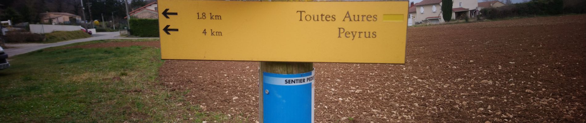
bois des masques/ St Vincent la Commanderie

okfred26
Gebruiker
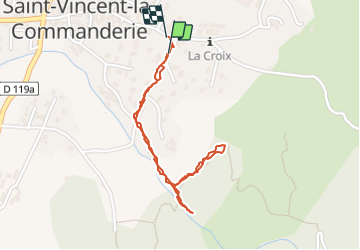

Lengte
2 km

Max. hoogte
470 m

Positief hoogteverschil
66 m
Km-Effort
2,9 km

Min. hoogte
395 m

Negatief hoogteverschil
67 m
Boucle
Ja
Datum van aanmaak :
2022-03-13 14:01:01.247
Laatste wijziging :
2022-03-13 15:03:58.336
34m
Moeilijkheid : Heel gemakkelijk

Gratisgps-wandelapplicatie
 SityTrail
IGN / Geografische instituten
SityTrail Plus
De wereld gaat voor u open
Over ons
Tocht Stappen van 2 km beschikbaar op Auvergne-Rhône-Alpes, Drôme, Saint-Vincent-la-Commanderie. Deze tocht wordt voorgesteld door okfred26.
Foto's


Plaatsbepaling
Land:
France
Regio :
Auvergne-Rhône-Alpes
Departement/Provincie :
Drôme
Gemeente :
Saint-Vincent-la-Commanderie
Locatie:
Unknown
Vertrek:(Dec)
Vertrek:(UTM)
667405 ; 4978192 (31T) N.
Opmerkingen