


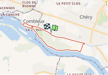
Checy Combleux

lemuid
Gebruiker

Lengte
6,6 km

Max. hoogte
104 m

Positief hoogteverschil
38 m
Km-Effort
7,1 km

Min. hoogte
91 m

Negatief hoogteverschil
39 m
Boucle
Ja
Datum van aanmaak :
2022-03-27 12:58:59.916
Laatste wijziging :
2022-03-27 15:46:47.538
1h32
Moeilijkheid : Heel gemakkelijk

Gratisgps-wandelapplicatie
 SityTrail
IGN / Geografische instituten
SityTrail Plus
De wereld gaat voor u open
Over ons
Tocht Stappen van 6,6 km beschikbaar op Centre-Val de Loire, Loiret, Chécy. Deze tocht wordt voorgesteld door lemuid.
Plaatsbepaling
Land:
France
Regio :
Centre-Val de Loire
Departement/Provincie :
Loiret
Gemeente :
Chécy
Locatie:
Unknown
Vertrek:(Dec)
Vertrek:(UTM)
425349 ; 5305127 (31T) N.
Opmerkingen