Tocht Stappen Sainte-Eulalie-en-Royans - 
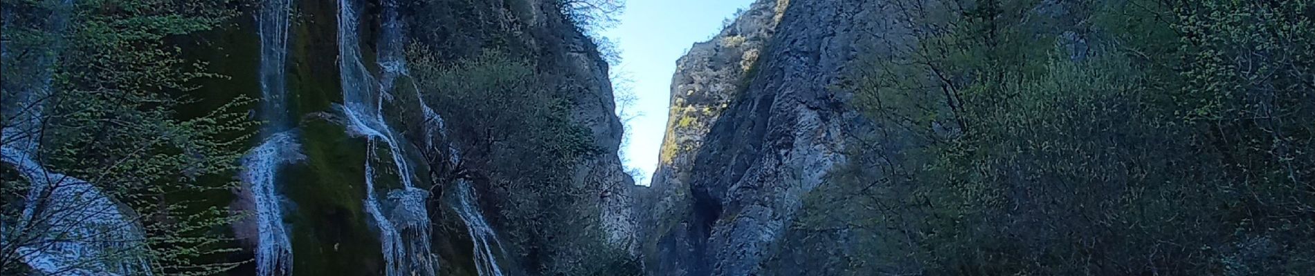
Cascade blanche et Cascade verte - Photo
 crocau
crocau

Gebruiker

© OpenStreetMap contributors
Lengte
Lengte
5,5 km
Max. hoogte
Max. hoogte
403 m
Positief hoogteverschil
222 m
Km-Effort
Km-Effort  
8,4 km
Min. hoogte
Min. hoogte
247 m
Negatief hoogteverschil
213 m
Boucle
Boucle
Ja
Datum van aanmaak :
2022-04-17 13:57:56.346
Laatste wijziging :
2022-04-17 18:08:05.448

(0 Bericht)

Stappen
Stappen
56m
Moeilijkheid : Heel gemakkelijk

Scan deze QR-code om de tocht te openen in de SityTrail-applicatie

Gratisgps-wandelapplicatie

Logo SityTrail SityTrail

IGN / Geografische instituten

SityTrail uit de App Store downloaden SityTrail uit Google Play downloaden

Logo SityTrail SityTrail Plus

De wereld gaat voor u open

SityTrail uit de App Store downloaden SityTrail uit Google Play downloaden SityTrail op Huawei AppGallery downloaden

Over ons

Tocht Stappen van 5,5 km beschikbaar op Auvergne-Rhône-Alpes, Drôme, Sainte-Eulalie-en-Royans. Deze tocht wordt voorgesteld door crocau.

Beschrijving

2 balades très faciles mais vraiment très agréables. Nous avons choisi de relier les deux en passant par les 5 tunnels en direction des Goulets. Il y a ensuite sur la gauche une route étroite qui descend au pont de Vernaison. Il faut tourner juste avant sur la gauche pour rejoindre la cascade verte. Magnifique !

Hoogteprofiel

Foto's

Plaatsbepaling

Land:
France
Regio :
Auvergne-Rhône-Alpes
Departement/Provincie :
Drôme
Gemeente :
Sainte-Eulalie-en-Royans
Locatie:
Unknown
Vertrek:(UTM)
684601 ; 4990827 (31T) N.


Sluiten
Mijn abonnementen