


La roche aux oiseaux

jeancl
Gebruiker

Lengte
5 km

Max. hoogte
55 m

Positief hoogteverschil
121 m
Km-Effort
6,6 km

Min. hoogte
0 m

Negatief hoogteverschil
123 m
Boucle
Ja
Datum van aanmaak :
2016-03-09 00:00:00.0
Laatste wijziging :
2016-03-09 00:00:00.0
1h30
Moeilijkheid : Gemakkelijk

Gratisgps-wandelapplicatie
 SityTrail
IGN / Geografische instituten
SityTrail Plus
De wereld gaat voor u open
Over ons
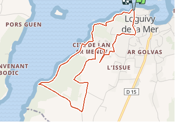
Tocht Stappen van 5 km beschikbaar op Bretagne, Côtes-d'Armor, Ploubazlanec. Deze tocht wordt voorgesteld door jeancl.
Plaatsbepaling
Land:
France
Regio :
Bretagne
Departement/Provincie :
Côtes-d'Armor
Gemeente :
Ploubazlanec
Locatie:
Unknown
Vertrek:(Dec)
Vertrek:(UTM)
495151 ; 5407627 (30U) N.
Opmerkingen