


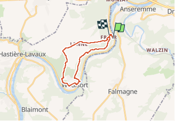
Freyr ADEPSboucle à partir du château.

thomarche
Gebruiker

Lengte
10,3 km

Max. hoogte
240 m

Positief hoogteverschil
299 m
Km-Effort
14,2 km

Min. hoogte
95 m

Negatief hoogteverschil
297 m
Boucle
Neen
Datum van aanmaak :
2022-05-08 12:30:37.0
Laatste wijziging :
2022-05-08 15:20:55.724
2h49
Moeilijkheid : Gemakkelijk

Gratisgps-wandelapplicatie
 SityTrail
IGN / Geografische instituten
SityTrail Plus
De wereld gaat voor u open
Over ons
Tocht Stappen van 10,3 km beschikbaar op Wallonië, Namen, Hastière. Deze tocht wordt voorgesteld door thomarche.
Beschrijving
Très beaux sentiers. Qd même aussi du macadam mais étroit et très peu passant. Sublimes points de vue au-dessus de Waulsort.
Plaatsbepaling
Land:
Belgium
Regio :
Wallonië
Departement/Provincie :
Namen
Gemeente :
Hastière
Locatie:
Unknown
Vertrek:(Dec)
Vertrek:(UTM)
634839 ; 5565283 (31U) N.
Opmerkingen