


Rochesson Cascade Bouchot

noelphil
Gebruiker
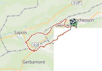

Lengte
7,4 km

Max. hoogte
570 m

Positief hoogteverschil
202 m
Km-Effort
10,1 km

Min. hoogte
468 m

Negatief hoogteverschil
196 m
Boucle
Neen
Datum van aanmaak :
2022-05-27 13:03:28.603
Laatste wijziging :
2022-05-27 16:04:16.898
3h00
Moeilijkheid : Medium

Gratisgps-wandelapplicatie
 SityTrail
IGN / Geografische instituten
SityTrail Plus
De wereld gaat voor u open
Over ons
Tocht Stappen van 7,4 km beschikbaar op Grand Est, Vogezen, Rochesson. Deze tocht wordt voorgesteld door noelphil.
Plaatsbepaling
Land:
France
Regio :
Grand Est
Departement/Provincie :
Vogezen
Gemeente :
Rochesson
Locatie:
Unknown
Vertrek:(Dec)
Vertrek:(UTM)
334272 ; 5320756 (32U) N.
Opmerkingen