


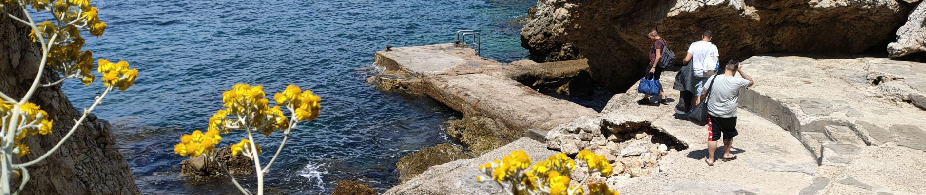
cap Antibes garoupe

fab4u
Gebruiker
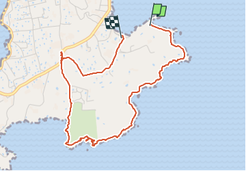

Lengte
5,1 km

Max. hoogte
40 m

Positief hoogteverschil
60 m
Km-Effort
5,9 km

Min. hoogte
0 m

Negatief hoogteverschil
63 m
Boucle
Neen
Datum van aanmaak :
2022-05-30 09:48:43.324
Laatste wijziging :
2022-05-30 10:56:45.69
1h07
Moeilijkheid : Gemakkelijk

Gratisgps-wandelapplicatie
 SityTrail
IGN / Geografische instituten
SityTrail Plus
De wereld gaat voor u open
Over ons
Tocht Stappen van 5,1 km beschikbaar op Provence-Alpes-Côte d'Azur, Alpes-Maritimes, Antibes. Deze tocht wordt voorgesteld door fab4u.
Foto's

Plaatsbepaling
Land:
France
Regio :
Provence-Alpes-Côte d'Azur
Departement/Provincie :
Alpes-Maritimes
Gemeente :
Antibes
Locatie:
Unknown
Vertrek:(Dec)
Vertrek:(UTM)
349759 ; 4824149 (32T) N.
Opmerkingen