


Randonnée USEP 2022

nicolas54230
Gebruiker

Lengte
12,1 km

Max. hoogte
423 m

Positief hoogteverschil
265 m
Km-Effort
15,7 km

Min. hoogte
219 m

Negatief hoogteverschil
273 m
Boucle
Neen
Datum van aanmaak :
2022-06-29 12:12:17.23
Laatste wijziging :
2022-06-29 12:13:06.76
3h33
Moeilijkheid : Gemakkelijk

Gratisgps-wandelapplicatie
 SityTrail
IGN / Geografische instituten
SityTrail Plus
De wereld gaat voor u open
Over ons
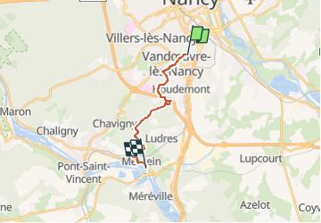
Tocht Te voet van 12,1 km beschikbaar op Grand Est, Meurthe-et-Moselle, Vandœuvre-lès-Nancy. Deze tocht wordt voorgesteld door nicolas54230.
Plaatsbepaling
Land:
France
Regio :
Grand Est
Departement/Provincie :
Meurthe-et-Moselle
Gemeente :
Vandœuvre-lès-Nancy
Locatie:
Unknown
Vertrek:(Dec)
Vertrek:(UTM)
292454 ; 5393921 (32U) N.
Opmerkingen