


Les lacs de millefonts

PhilB24
Gebruiker
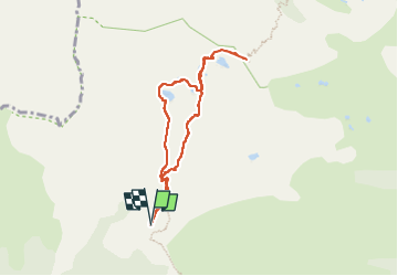

Lengte
7,4 km

Max. hoogte
2453 m

Positief hoogteverschil
427 m
Km-Effort
13,1 km

Min. hoogte
2033 m

Negatief hoogteverschil
428 m
Boucle
Ja
Datum van aanmaak :
2022-07-03 09:47:05.292
Laatste wijziging :
2022-07-14 16:48:06.008
2h15
Moeilijkheid : Medium

Gratisgps-wandelapplicatie
 SityTrail
IGN / Geografische instituten
SityTrail Plus
De wereld gaat voor u open
Over ons
Tocht Stappen van 7,4 km beschikbaar op Provence-Alpes-Côte d'Azur, Alpes-Maritimes, Valdeblore. Deze tocht wordt voorgesteld door PhilB24.
Beschrijving
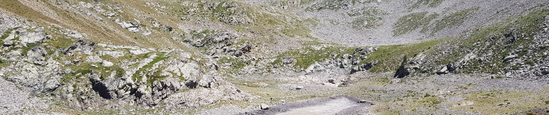
parking des millefonts, ST Dalmas. Tour des lacs jusqu'au col de Barn. Possibilité de poursuivre vers le mont Pepoiri.
Foto's


Plaatsbepaling
Land:
France
Regio :
Provence-Alpes-Côte d'Azur
Departement/Provincie :
Alpes-Maritimes
Gemeente :
Valdeblore
Locatie:
Unknown
Vertrek:(Dec)
Vertrek:(UTM)
354847 ; 4884417 (32T) N.
Opmerkingen