


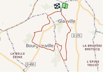
2014-08-08 Rando Glanville Le Bois des Sources

jchezlemas
Gebruiker

Lengte
8,2 km

Max. hoogte
133 m

Positief hoogteverschil
154 m
Km-Effort
10,3 km

Min. hoogte
58 m

Negatief hoogteverschil
156 m
Boucle
Ja
Datum van aanmaak :
2014-12-10 00:00:00.0
Laatste wijziging :
2014-12-10 00:00:00.0
2h13
Moeilijkheid : Gemakkelijk

Gratisgps-wandelapplicatie
 SityTrail
IGN / Geografische instituten
SityTrail Plus
De wereld gaat voor u open
Over ons
Tocht Stappen van 8,2 km beschikbaar op Normandië, Calvados, Glanville. Deze tocht wordt voorgesteld door jchezlemas.
Plaatsbepaling
Land:
France
Regio :
Normandië
Departement/Provincie :
Calvados
Gemeente :
Glanville
Locatie:
Unknown
Vertrek:(Dec)
Vertrek:(UTM)
286763 ; 5463424 (31U) N.
Opmerkingen