


Vent des forêts

lorenzot54
Gebruiker
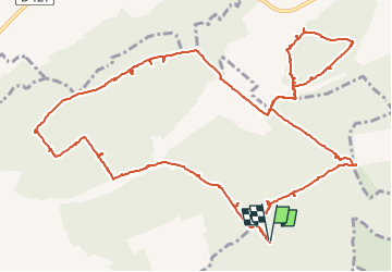

Lengte
16 km

Max. hoogte
345 m

Positief hoogteverschil
191 m
Km-Effort
18,6 km

Min. hoogte
271 m

Negatief hoogteverschil
189 m
Boucle
Ja
Datum van aanmaak :
2022-07-27 11:26:42.0
Laatste wijziging :
2022-07-27 16:16:09.408
2h36
Moeilijkheid : Gemakkelijk

Gratisgps-wandelapplicatie
 SityTrail
IGN / Geografische instituten
SityTrail Plus
De wereld gaat voor u open
Over ons
Tocht Mountainbike van 16 km beschikbaar op Grand Est, Meuse, Nicey-sur-Aire. Deze tocht wordt voorgesteld door lorenzot54.
Plaatsbepaling
Land:
France
Regio :
Grand Est
Departement/Provincie :
Meuse
Gemeente :
Nicey-sur-Aire
Locatie:
Unknown
Vertrek:(Dec)
Vertrek:(UTM)
674908 ; 5419972 (31U) N.
Opmerkingen