


Les Echelles-2018-05-09
mini balades Adapar
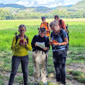
Une équipe à votre service garant de convivialité et bonne humeur
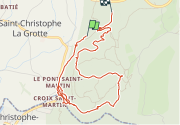

Lengte
6,2 km

Max. hoogte
599 m

Positief hoogteverschil
304 m
Km-Effort
10,2 km

Min. hoogte
416 m

Negatief hoogteverschil
275 m
Boucle
Neen
Datum van aanmaak :
2022-08-03 12:28:03.739
Laatste wijziging :
2022-08-03 12:28:03.739
2h19
Moeilijkheid : Gemakkelijk

Gratisgps-wandelapplicatie
 SityTrail
IGN / Geografische instituten
SityTrail Plus
De wereld gaat voor u open
Over ons
Tocht Te voet van 6,2 km beschikbaar op Auvergne-Rhône-Alpes, Savoie, Saint-Christophe. Deze tocht wordt voorgesteld door mini balades Adapar.
Plaatsbepaling
Land:
France
Regio :
Auvergne-Rhône-Alpes
Departement/Provincie :
Savoie
Gemeente :
Saint-Christophe
Locatie:
Unknown
Vertrek:(Dec)
Vertrek:(UTM)
717966 ; 5036649 (31T) N.
Opmerkingen