


Belleville

PhilippeC54
Gebruiker

Lengte
41 km

Max. hoogte
328 m

Positief hoogteverschil
590 m
Km-Effort
49 km

Min. hoogte
176 m

Negatief hoogteverschil
587 m
Boucle
Neen
Datum van aanmaak :
2022-11-06 07:30:01.558
Laatste wijziging :
2022-11-06 11:01:38.885
2h57
Moeilijkheid : Medium

Gratisgps-wandelapplicatie
 SityTrail
IGN / Geografische instituten
SityTrail Plus
De wereld gaat voor u open
Over ons
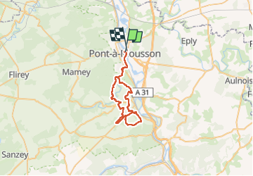
Tocht Mountainbike van 41 km beschikbaar op Grand Est, Meurthe-et-Moselle, Pont-à-Mousson. Deze tocht wordt voorgesteld door PhilippeC54.
Plaatsbepaling
Land:
France
Regio :
Grand Est
Departement/Provincie :
Meurthe-et-Moselle
Gemeente :
Pont-à-Mousson
Locatie:
Unknown
Vertrek:(Dec)
Vertrek:(UTM)
284292 ; 5420977 (32U) N.
Opmerkingen