


La Table Ronde de Montgrésin_Trace_12,1 km

Pousscailleux
Gebruiker
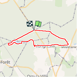

Lengte
12,1 km

Max. hoogte
72 m

Positief hoogteverschil
102 m
Km-Effort
13,5 km

Min. hoogte
45 m

Negatief hoogteverschil
104 m
Boucle
Ja
Datum van aanmaak :
2014-12-10 00:00:00.0
Laatste wijziging :
2014-12-10 00:00:00.0
2h59
Moeilijkheid : Onbekend

Gratisgps-wandelapplicatie
 SityTrail
IGN / Geografische instituten
SityTrail Plus
De wereld gaat voor u open
Over ons
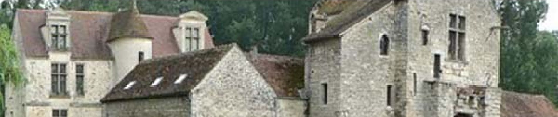
Tocht Stappen van 12,1 km beschikbaar op Hauts-de-France, Oise, Chantilly. Deze tocht wordt voorgesteld door Pousscailleux.
Beschrijving
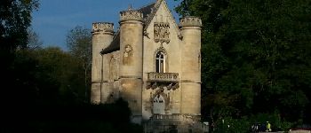
Départ de La Table Ronde de Montgrésin
Foto's


Plaatsbepaling
Land:
France
Regio :
Hauts-de-France
Departement/Provincie :
Oise
Gemeente :
Chantilly
Locatie:
Unknown
Vertrek:(Dec)
Vertrek:(UTM)
464173 ; 5446072 (31U) N.
Opmerkingen