


F723 La forêt d'Anciotta

geranimo
Gebruiker

Lengte
12,2 km

Max. hoogte
376 m

Positief hoogteverschil
158 m
Km-Effort
14,3 km

Min. hoogte
287 m

Negatief hoogteverschil
160 m
Boucle
Ja
Datum van aanmaak :
2022-11-26 18:02:08.699
Laatste wijziging :
2022-11-26 18:02:48.645
3h14
Moeilijkheid : Medium

Gratisgps-wandelapplicatie
 SityTrail
IGN / Geografische instituten
SityTrail Plus
De wereld gaat voor u open
Over ons
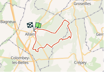
Tocht Stappen van 12,2 km beschikbaar op Grand Est, Meurthe-et-Moselle, Allain. Deze tocht wordt voorgesteld door geranimo.
Plaatsbepaling
Land:
France
Regio :
Grand Est
Departement/Provincie :
Meurthe-et-Moselle
Gemeente :
Allain
Locatie:
Unknown
Vertrek:(Dec)
Vertrek:(UTM)
715089 ; 5381620 (31U) N.
Opmerkingen