


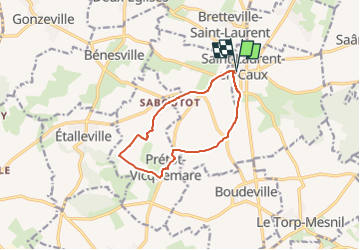
St LAURENT en CAUX

juanluco76
Gebruiker

Lengte
9,7 km

Max. hoogte
155 m

Positief hoogteverschil
92 m
Km-Effort
11 km

Min. hoogte
121 m

Negatief hoogteverschil
95 m
Boucle
Ja
Datum van aanmaak :
2023-02-26 22:29:44.81
Laatste wijziging :
2023-02-26 22:32:37.92
2h29
Moeilijkheid : Medium

Gratisgps-wandelapplicatie
 SityTrail
IGN / Geografische instituten
SityTrail Plus
De wereld gaat voor u open
Over ons
Tocht Stappen van 9,7 km beschikbaar op Normandië, Seine-Maritime, Saint-Laurent-en-Caux. Deze tocht wordt voorgesteld door juanluco76.
Plaatsbepaling
Land:
France
Regio :
Normandië
Departement/Provincie :
Seine-Maritime
Gemeente :
Saint-Laurent-en-Caux
Locatie:
Unknown
Vertrek:(Dec)
Vertrek:(UTM)
347112 ; 5513109 (31U) N.
Opmerkingen