


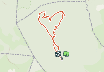

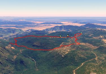
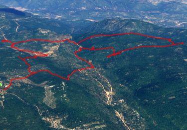
12,6 km | 16,7 km-effort


Gebruiker


Gratisgps-wandelapplicatie
 SityTrail
IGN / Geografische instituten
SityTrail World
De wereld gaat voor u open
Tocht Stappen van 9,4 km beschikbaar op Provence-Alpes-Côte d'Azur, Var, Solliès-Toucas. Deze tocht wordt voorgesteld door chrifor.
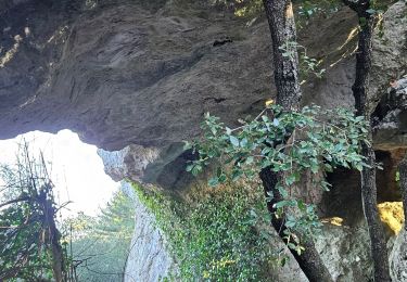
A la découverte des gouffres, arches, grottes, hippopotame, éléphant et autres surprises géologiques du plateau de Signes.
A compléter.


Stappen
Stappen
Stappen
Stappen

Stappen

Stappen
Stappen

Stappen

Lopen