


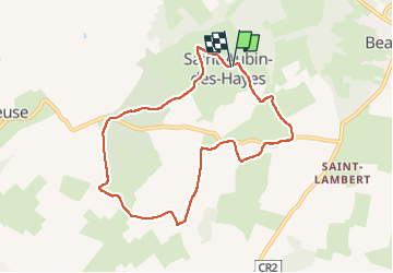
Saint Aubin les Hayes

werth
Gebruiker

Lengte
7,8 km

Max. hoogte
175 m

Positief hoogteverschil
53 m
Km-Effort
8,5 km

Min. hoogte
150 m

Negatief hoogteverschil
52 m
Boucle
Ja
Datum van aanmaak :
2023-02-28 08:03:27.458
Laatste wijziging :
2023-03-12 13:22:09.647
2h17
Moeilijkheid : Medium

Gratisgps-wandelapplicatie
 SityTrail
IGN / Geografische instituten
SityTrail Plus
De wereld gaat voor u open
Over ons
Tocht Stappen van 7,8 km beschikbaar op Normandië, Eure, Mesnil-en-Ouche. Deze tocht wordt voorgesteld door werth.
Plaatsbepaling
Land:
France
Regio :
Normandië
Departement/Provincie :
Eure
Gemeente :
Mesnil-en-Ouche
Locatie:
Unknown
Vertrek:(Dec)
Vertrek:(UTM)
330294 ; 5431060 (31U) N.
Opmerkingen