


Rando 4L

jojo02
Gebruiker

Lengte
88 km

Max. hoogte
184 m

Positief hoogteverschil
1036 m
Km-Effort
102 km

Min. hoogte
36 m

Negatief hoogteverschil
1036 m
Boucle
Ja
Datum van aanmaak :
2023-03-17 13:34:44.0
Laatste wijziging :
2023-03-17 17:53:32.31
4h16
Moeilijkheid : Gemakkelijk

Gratisgps-wandelapplicatie
 SityTrail
IGN / Geografische instituten
SityTrail Plus
De wereld gaat voor u open
Over ons
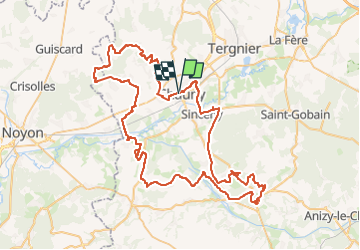
Tocht 4x4 van 88 km beschikbaar op Hauts-de-France, Aisne, Chauny. Deze tocht wordt voorgesteld door jojo02.
Plaatsbepaling
Land:
France
Regio :
Hauts-de-France
Departement/Provincie :
Aisne
Gemeente :
Chauny
Locatie:
Unknown
Vertrek:(Dec)
Vertrek:(UTM)
515550 ; 5496032 (31U) N.
Opmerkingen