Tocht Ski randonnée Abriès-Ristolas - pic de Segure (Ristolas) - Photo
 tchoua
tchoua

Gebruiker

© OpenStreetMap contributors
Lengte
Lengte
13,2 km
Max. hoogte
Max. hoogte
2970 m
Positief hoogteverschil
1354 m
Km-Effort
Km-Effort  
31 km
Min. hoogte
Min. hoogte
1610 m
Negatief hoogteverschil
1354 m
Boucle
Boucle
Ja
Datum van aanmaak :
2023-03-20 06:35:46.993
Laatste wijziging :
2023-03-22 13:22:39.386

(0 Bericht)

Ski randonnée
Ski randonnée
3h15
Moeilijkheid : Medium

Scan deze QR-code om de tocht te openen in de SityTrail-applicatie

Gratisgps-wandelapplicatie

Logo SityTrail SityTrail

IGN / Geografische instituten

SityTrail uit de App Store downloaden SityTrail uit Google Play downloaden

Logo SityTrail SityTrail World

De wereld gaat voor u open

SityTrail uit de App Store downloaden SityTrail uit Google Play downloaden SityTrail op Huawei AppGallery downloaden

Over ons

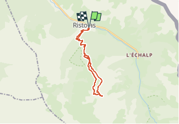
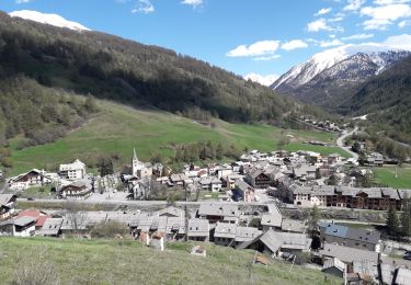
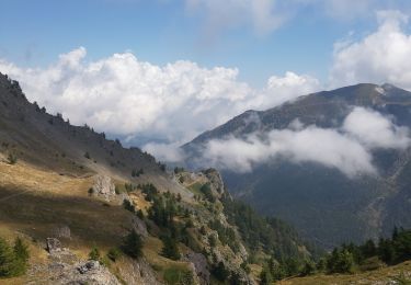
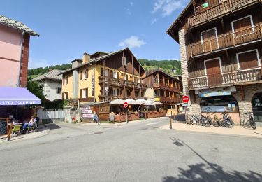
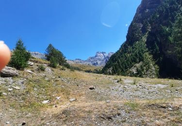
Tocht Ski randonnée van 13,2 km beschikbaar op Provence-Alpes-Côte d'Azur, Hautes-Alpes, Abriès-Ristolas. Deze tocht wordt voorgesteld door tchoua.

Beschrijving

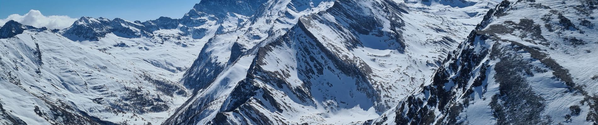
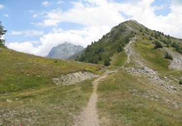
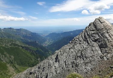
Randonnée à ski hiver ou à pied l été, facile pas de difficulté si ce n est la longueur ( cela reste relatif) pas de difficulté majeure bien suivre les chemins de traînes forestières au début dans le bois puis lorsqu on atteint la limite supérieure des arbres faire une longue traversée ascendante vers la droite en direction du pic de Ségure ne pas le confondre avec  le pic de chabriere qui est avant et moins haut ,du sommet une belle vue sur 360 ° vous récompense.

Hoogteprofiel

Foto's

Plaatsbepaling

Land:
France
Regio :
Provence-Alpes-Côte d'Azur
Departement/Provincie :
Hautes-Alpes
Gemeente :
Abriès-Ristolas
Locatie:
Unknown
Vertrek:(UTM)
338495 ; 4959739 (32T) N.

Wandeltochten in de omgeving

Tocht Stappen Abriès-Ristolas - collette et crête de Gilly - Photo
Stappen
GUIDE
amiral13

Stappen

Gemakkelijk
(1)
Abriès-Ristolas, Provence-Alpes-Côte d'Azur, Hautes-Alpes, France
6,5 km | 13,7 km-effort
3h 51min
Ja
Tocht Stappen Abriès-Ristolas - Abriès - Aiguilles - Photo
Stappen
GUIDE
romanceline

Stappen

Moeilijk
Abriès-Ristolas, Provence-Alpes-Côte d'Azur, Hautes-Alpes, France
16,9 km | 32 km-effort
7h 19min
Neen
Tocht Stappen Abriès-Ristolas - Abriès - Aiguilles - Photo
Stappen
GUIDE
romanceline

Stappen

Moeilijk
Abriès-Ristolas, Provence-Alpes-Côte d'Azur, Hautes-Alpes, France
16,9 km | 32 km-effort
7h 19min
Neen
Tocht Stappen Abriès-Ristolas - col d'Urine et Maït d'Amunt - Photo
Stappen
GUIDE
amiral13

Stappen

Medium
Abriès-Ristolas, Provence-Alpes-Côte d'Azur, Hautes-Alpes, France
13,2 km | 26 km-effort
5h 56min
Ja
Tocht Stappen Abriès-Ristolas - Le Bois Noir - Photo
Stappen
patrando49

Stappen

Gemakkelijk
(2)
Abriès-Ristolas, Provence-Alpes-Côte d'Azur, Hautes-Alpes, France
4,5 km | 6,8 km-effort
2h 0min
Ja
Tocht Stappen Abriès-Ristolas - Malrif à partir de Abries - Photo
Stappen
Sorriaux

Stappen

Medium
Abriès-Ristolas, Provence-Alpes-Côte d'Azur, Hautes-Alpes, France
9,8 km | 17,1 km-effort
3h 36min
Ja
Tocht Stappen Abriès-Ristolas - l echalp, la montat - Photo
Stappen
FLORENSAC

Stappen

Moeilijk
Abriès-Ristolas, Provence-Alpes-Côte d'Azur, Hautes-Alpes, France
9,4 km | 18,1 km-effort
4h 51min
Ja
Tocht Stappen Abriès-Ristolas - Queyras 08 - Ristolas - Abriès - Photo
Stappen
uru2010

Stappen

Zeer moeilijk
Abriès-Ristolas, Provence-Alpes-Côte d'Azur, Hautes-Alpes, France
16,5 km | 28 km-effort
8h 2min
Neen
Tocht Stappen Abriès-Ristolas - Belvédère  du Viso - Photo
Stappen
Abigail

Stappen

Medium
Abriès-Ristolas, Provence-Alpes-Côte d'Azur, Hautes-Alpes, France
8,9 km | 12,6 km-effort
2h 27min
Neen


Sluiten
Mijn abonnementen