Tocht Stappen Fontaine-Chaalis - t264479859_bois de perthe - Photo

t264479859_bois de perthe

 Pousscailleux
Pousscailleux

Gebruiker

© OpenStreetMap contributors
Lengte
Lengte
6,3 km
Max. hoogte
Max. hoogte
133 m
Positief hoogteverschil
92 m
Km-Effort
Km-Effort  
7,5 km
Min. hoogte
Min. hoogte
70 m
Negatief hoogteverschil
90 m
Boucle
Boucle
Ja
Datum van aanmaak :
2023-04-14 09:09:51.596
Laatste wijziging :
2023-04-16 17:12:09.82

(0 Bericht)

Stappen
Stappen
1h42
Moeilijkheid : Medium

Scan deze QR-code om de tocht te openen in de SityTrail-applicatie

Gratisgps-wandelapplicatie

Logo SityTrail SityTrail

IGN / Geografische instituten

SityTrail uit de App Store downloaden SityTrail uit Google Play downloaden

Logo SityTrail SityTrail Plus

De wereld gaat voor u open

SityTrail uit de App Store downloaden SityTrail uit Google Play downloaden SityTrail op Huawei AppGallery downloaden

Over ons

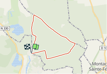
Tocht Stappen van 6,3 km beschikbaar op Hauts-de-France, Oise, Fontaine-Chaalis. Deze tocht wordt voorgesteld door Pousscailleux.

Beschrijving

Arbre remarquable, "l'Ancêtre de Perthe", N 49° 08.254 / E 002° 43.494, 37 m de haut et âgé de 250 ans, peut-être le plus vieux chêne sessile de cette forêt, n'est plus. Déjà déclaré "arbre solide mais à surveiller" en mai 2002 par un expert de l'ONF, et dépourvu de feuillage en 2016, il est, comme beaucoup d'autres grands arbres de sa section, définitivement manquant.

Hoogteprofiel

Plaatsbepaling

Land:
France
Regio :
Hauts-de-France
Departement/Provincie :
Oise
Gemeente :
Fontaine-Chaalis
Locatie:
Unknown
Vertrek:(UTM)
477878 ; 5442544 (31U) N.


Sluiten
Mijn abonnementen