


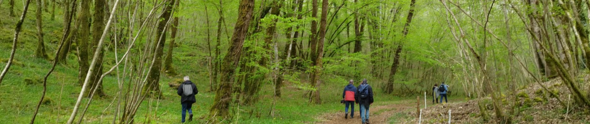
La randonnée de l'ail des ours de Bunzac.

alainjoseph6
Gebruiker

Lengte
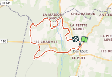
9,3 km

Max. hoogte
120 m

Positief hoogteverschil
124 m
Km-Effort
10,9 km

Min. hoogte
79 m

Negatief hoogteverschil
123 m
Boucle
Ja
Datum van aanmaak :
2023-04-23 07:47:36.163
Laatste wijziging :
2024-04-09 06:26:01.71
2h28
Moeilijkheid : Medium

Gratisgps-wandelapplicatie
 SityTrail
IGN / Geografische instituten
SityTrail Plus
De wereld gaat voor u open
Over ons
Tocht Stappen van 9,3 km beschikbaar op Nieuw-Aquitanië, Charente, Bunzac. Deze tocht wordt voorgesteld door alainjoseph6.
Beschrijving
Une super 👍 randonnée à découvrir absolument. Vous pouvez voir le gouffre de chez Roby,les jonquilles sauvage au printemps, une vallée avec l'ail des ours, du muguet en mai.
Foto's


Plaatsbepaling
Land:
France
Regio :
Nieuw-Aquitanië
Departement/Provincie :
Charente
Gemeente :
Bunzac
Locatie:
Unknown
Vertrek:(Dec)
Vertrek:(UTM)
293826 ; 5064399 (31T) N.
Opmerkingen
rando sympa mais porte mal sont nom 0 je dit bien 0 ail des ours trouver