


Waha DEPS

thomarche
Gebruiker
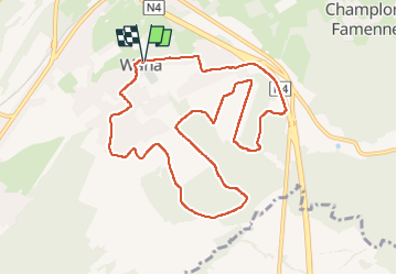

Lengte
10,2 km

Max. hoogte
376 m

Positief hoogteverschil
251 m
Km-Effort
13,6 km

Min. hoogte
281 m

Negatief hoogteverschil
251 m
Boucle
Ja
Datum van aanmaak :
2023-05-18 13:37:17.0
Laatste wijziging :
2023-05-18 16:04:34.379
2h26
Moeilijkheid : Onbekend

Gratisgps-wandelapplicatie
 SityTrail
IGN / Geografische instituten
SityTrail Plus
De wereld gaat voor u open
Over ons
Tocht Stappen van 10,2 km beschikbaar op Wallonië, Luxemburg, Marche-en-Famenne. Deze tocht wordt voorgesteld door thomarche.
Beschrijving
Démarrage macadam puis long N4 mais superbes chemins tout du long après. Avec vue extraordinairement large au milieu. Très belle église de Waha.
Plaatsbepaling
Land:
Belgium
Regio :
Wallonië
Departement/Provincie :
Luxemburg
Gemeente :
Marche-en-Famenne
Locatie:
Unknown
Vertrek:(Dec)
Vertrek:(UTM)
667289 ; 5564860 (31U) N.
Opmerkingen