


foret de crecy

Martelpierre
Gebruiker

Lengte
17,7 km

Max. hoogte
96 m

Positief hoogteverschil
181 m
Km-Effort
20 km

Min. hoogte
52 m

Negatief hoogteverschil
181 m
Boucle
Ja
Datum van aanmaak :
2023-04-30 13:22:42.47
Laatste wijziging :
2023-05-21 14:23:38.216
1h24
Moeilijkheid : Medium

Gratisgps-wandelapplicatie
 SityTrail
IGN / Geografische instituten
SityTrail Plus
De wereld gaat voor u open
Over ons
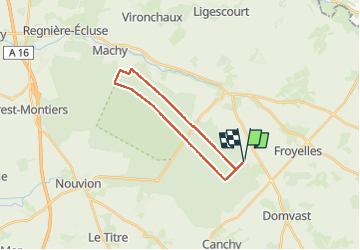
Tocht Mountainbike van 17,7 km beschikbaar op Hauts-de-France, Somme, Crécy-en-Ponthieu. Deze tocht wordt voorgesteld door Martelpierre.
Beschrijving
circuit depuis marche ville jusqu'à Nouvion
Plaatsbepaling
Land:
France
Regio :
Hauts-de-France
Departement/Provincie :
Somme
Gemeente :
Crécy-en-Ponthieu
Locatie:
Crécy-en-Ponthieu
Vertrek:(Dec)
Vertrek:(UTM)
421010 ; 5563901 (31U) N.
Opmerkingen