


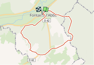
Fontaine l'abbé 3

werth
Gebruiker

Lengte
8,4 km

Max. hoogte
160 m

Positief hoogteverschil
147 m
Km-Effort
10,4 km

Min. hoogte
85 m

Negatief hoogteverschil
146 m
Boucle
Ja
Datum van aanmaak :
2023-06-20 06:56:03.838
Laatste wijziging :
2023-06-20 09:33:11.624
2h35
Moeilijkheid : Medium

Gratisgps-wandelapplicatie
 SityTrail
IGN / Geografische instituten
SityTrail Plus
De wereld gaat voor u open
Over ons
Tocht Stappen van 8,4 km beschikbaar op Normandië, Eure, Fontaine-l'Abbé. Deze tocht wordt voorgesteld door werth.
Foto's


Plaatsbepaling
Land:
France
Regio :
Normandië
Departement/Provincie :
Eure
Gemeente :
Fontaine-l'Abbé
Locatie:
Unknown
Vertrek:(Dec)
Vertrek:(UTM)
331494 ; 5440165 (31U) N.
Opmerkingen