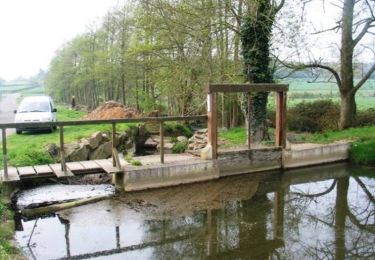
Tocht Stappen Beaulieu - [Itinéraire] Autour du bourg - Photo

[Itinéraire] Autour du bourg

 ODDAD78
ODDAD78

Gebruiker

© OpenStreetMap contributors
Lengte
Lengte
4,2 km
Max. hoogte
Max. hoogte
222 m
Positief hoogteverschil
28 m
Km-Effort
Km-Effort  
4,6 km
Min. hoogte
Min. hoogte
201 m
Negatief hoogteverschil
28 m
Boucle
Boucle
Ja
Datum van aanmaak :
2023-07-03 07:49:22.838
Laatste wijziging :
2023-07-03 07:51:35.029

(0 Bericht)

Stappen
Stappen
1h02
Moeilijkheid : Gemakkelijk

Scan deze QR-code om de tocht te openen in de SityTrail-applicatie

Gratisgps-wandelapplicatie

Logo SityTrail SityTrail

IGN / Geografische instituten

SityTrail uit de App Store downloaden SityTrail uit Google Play downloaden

Logo SityTrail SityTrail World

De wereld gaat voor u open

SityTrail uit de App Store downloaden SityTrail uit Google Play downloaden SityTrail op Huawei AppGallery downloaden

Over ons

Tocht Stappen van 4,2 km beschikbaar op Normandië, Orne, Beaulieu. Deze tocht wordt voorgesteld door ODDAD78.

Beschrijving

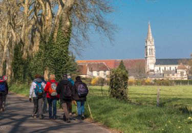
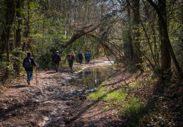
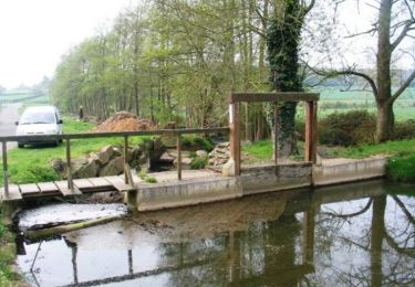
A partir du bois de Beaulieu, partez à la découverte du village, de son histoire et de ses patrimoines : lavloir, église, château...
Avant ou après avoir profité de l'arboretum de Beaulieu, partez flâner dans le village. Le parcours est agrémenté de panneaux informatifs.
Départ / Arrivée : Beaulieu
Prendre la direction du bourg.
Au carrefour du monument aux Morts prendre à gauche en direction de l'église. Puis, prendre à droite, la D 358. Au carrefour, prendre à droite vers "La Crustière".
Avant "Le Marchis" prendre  à droite vers "L'Anjouisière" et suivre la route à droite jusqu'à passer devant le château du Breuil.
Rejoindre la D 258 et prendre à droite en direction de Beaulieu, puis, au carrefour, prendre à gauche pour rejoindre l'arboretum.

Source : https://rando-perche.fr/a-pied/autour-du-bourg/

Hoogteprofiel

POI's

Plaatsbepaling

Land:
France
Regio :
Normandië
Departement/Provincie :
Orne
Gemeente :
Beaulieu
Locatie:
Unknown
Vertrek:(Dec)
Vertrek:(UTM)
334129 ; 5394055 (31U) N.

Wandeltochten in de omgeving

Tocht Stappen Charencey - Saint-Maurice-lès-Charencey - Soligny-la-Trappe 25 km - Photo
Stappen

Stappen

Medium
Charencey, Normandië, Orne, France
24 km | 28 km-effort
6h 22min
Neen
Tocht Stappen Charencey - Saint-Maurice-les-Charencey - Tourouvre 28 km - Photo
Stappen

Stappen

Gemakkelijk
Charencey, Normandië, Orne, France
26 km | 30 km-effort
6h 53min
Neen
Tocht Stappen Chennebrun - Circuit des Normands - Chennebrun - Photo
Stappen
tracegps

Stappen

Gemakkelijk
Chennebrun, Normandië, Eure, France
5,5 km | 5,9 km-effort
1h 19min
Ja
Tocht Stappen Gournay-le-Guérin - Circuit des Fermes -  Gournay-le-Guérin  - Photo
Stappen
tracegps

Stappen

Gemakkelijk
Gournay-le-Guérin, Normandië, Eure, France
7,3 km | 7,9 km-effort
1h 49min
Ja
Tocht Stappen Chennebrun - Circuit des Normands - Chennebrun  - Photo
Stappen
tracegps

Stappen

Gemakkelijk
Chennebrun, Normandië, Eure, France
5,5 km | 5,9 km-effort
1h 19min
Ja
Tocht Stappen Beaulieu - [Itinéraire] D'un calvaire à l'autre - Photo
Stappen
ODDAD78

Stappen

Medium
Beaulieu, Normandië, Orne, France
5,7 km | 6,3 km-effort
1h 25min
Ja
Tocht Stappen Saint-Christophe-sur-Avre - st Christophe - Photo
Stappen
bipf

Stappen

Heel gemakkelijk
Saint-Christophe-sur-Avre, Normandië, Eure, France
510 m | 556 m-effort
15min
Neen
Tocht Stappen Charencey - TPE 2018 Etape 3 Saint-Maurice-lès-Charencey - Tourouvre 26,1Km - Photo
Stappen
ODDAD78

Stappen

Medium
Charencey, Normandië, Orne, France
26 km | 31 km-effort
6h 43min
Neen
Tocht Stappen Beaulieu - Beaulieu  - Photo
Stappen
ODDAD78

Stappen

Medium
Beaulieu, Normandië, Orne, France
10,2 km | 11,3 km-effort
2h 58min
Neen


Sluiten
Mijn abonnementen