![](/images/other/stat-length.png)
![Tocht Stappen Reugny - Reugny - Photo](https://media.geolcdn.com/t/1900/400/ext.pjpeg?maxdim=2&url=https%3A%2F%2Fmedia.geolcdn.com%2Ff%2F9737bd3c-0f78-4183-94d0-7e9e6779b234.jpg)
Reugny
guydu41
Gebruiker
![Lengte](/images/other/stat-length.png)
![Max. hoogte](https://static1.geolcdn.com/siteimages/upload/files/1508320355ic_sort_altitude_max_24dp.png)
![Positief hoogteverschil](https://static1.geolcdn.com/siteimages/upload/files/1508320355ic_sort_den_pos_24dp.png)
![Km-Effort](/images/other/stat-length.png)
![Min. hoogte](https://static1.geolcdn.com/siteimages/upload/files/1508320355ic_sort_altitude_min_24dp.png)
![Negatief hoogteverschil](https://static1.geolcdn.com/siteimages/upload/files/1508320355ic_sort_den_neg_24dp.png)
![Boucle](https://static1.geolcdn.com/siteimages/upload/files/16400158638029165_repeat_loop_refresh_sync_direction_icon.png)
![Stappen](https://static1.geolcdn.com/sitytour/trail-icons/101.png)
3h17
Moeilijkheid : Medium
![Scan deze QR-code om de tocht te openen in de SityTrail-applicatie](https://capi.geolives.com/qq0zvz2zws4bq2lad0pu/sitytour/trails/3736943/qr.png?size=200)
Gratisgps-wandelapplicatie
Over ons
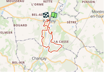
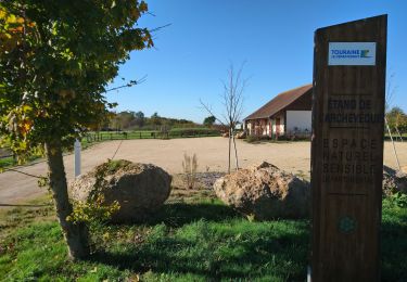
Tocht Stappen van 11,6 km beschikbaar op Centre-Val de Loire, Indre-et-Loire, Reugny. Deze tocht wordt voorgesteld door guydu41.
Beschrijving
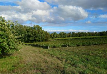
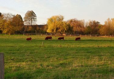
Très beau circuit qui suit globalement un parcours balisé jaune.
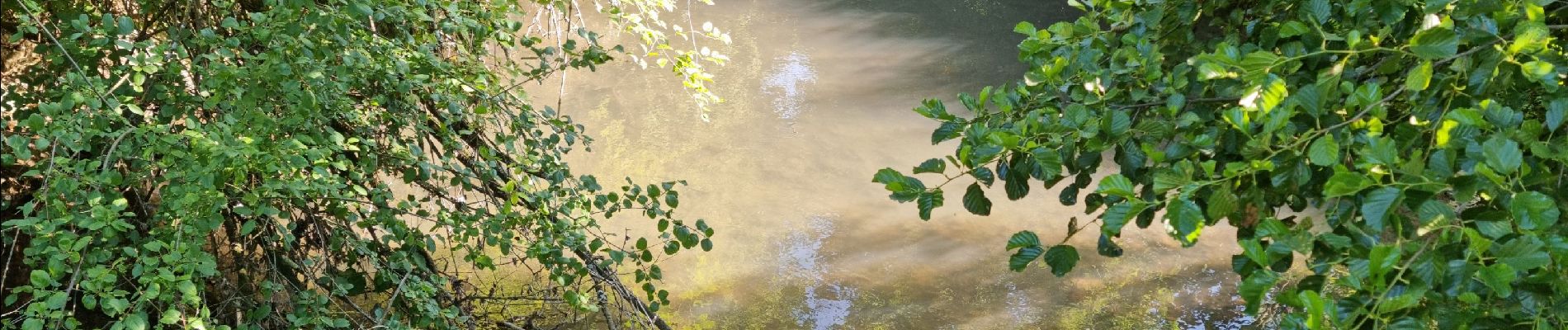
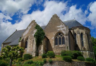
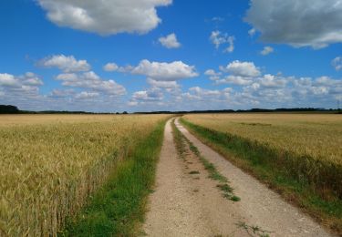
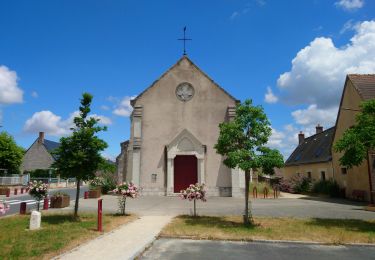
Il a été légèrement modifié pour commencer depuis un parking au début de la piste cyclable et permettre de découvrir des sentiers, passages, ruelles, passerelles au-dessus de petits cours d'eau, lavoir, église du charmant village de Reugny.
Derrière la Mairie, un escalier métallique permet d'accéder à un sentier dans un bois qui rejoint le circuit balisé.
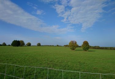
Note : Un passage communal sur les hauteurs de Reugny est embroussaillé mais peut être évité en passant par la Rue Pasteur puis la Rue de la Duchaie.
En toute fin du parcours, le chemin parallèle à la piste cyclable traverse un petit gué qui peut être difficilement franchissable en saison pluvieuse. Dans ce cas, emprunter la piste cyclable.
Plaatsbepaling
Opmerkingen
Wandeltochten in de omgeving
![Tocht Stappen Reugny - Reugny - Zig zag Valmer - 18.5km 315m 4h05 - 2024 05 02 - Photo](https://media.geolcdn.com/t/375/260/ext.jpg?maxdim=2&url=https%3A%2F%2Fmedia.geolcdn.com%2Ff%2F5cefbb13-711f-489c-8316-c9b5796f139d.jpg)
![Stappen Stappen](https://static1.geolcdn.com/sitytour/trail-icons/101.png)
Stappen
![](/images/other/stat-length.png)
![](https://static1.geolcdn.com/siteimages/upload/files/16400158638029165_repeat_loop_refresh_sync_direction_icon.png)
![Tocht Stappen Chançay - Chançay - Zig zag Reugny GR655ouest - 20.3km 380m 4h40 (40mn) - 2024 04 28 - Photo](https://media.geolcdn.com/t/375/260/ext.jpg?maxdim=2&url=https%3A%2F%2Fmedia.geolcdn.com%2Ff%2Fefedd979-b27d-4d96-b85e-cafd7eb7449e.jpg)
![Stappen Stappen](https://static1.geolcdn.com/sitytour/trail-icons/101.png)
Stappen
![](/images/other/stat-length.png)
![](https://static1.geolcdn.com/siteimages/upload/files/16400158638029165_repeat_loop_refresh_sync_direction_icon.png)
![Tocht Stappen Chançay - Chançay - Vaux et le Bois de Chançay - 8.7km 150m 2h05 - 2023 09 19 - Photo](https://media.geolcdn.com/t/375/260/ext.jpg?maxdim=2&url=https%3A%2F%2Fmedia.geolcdn.com%2Ff%2F786bee5a-6029-4ac7-a35b-1f5de9be2a5c.jpg)
![Stappen Stappen](https://static1.geolcdn.com/sitytour/trail-icons/101.png)
Stappen
![](/images/other/stat-length.png)
![](https://static1.geolcdn.com/siteimages/upload/files/16400158638029165_repeat_loop_refresh_sync_direction_icon.png)
![Tocht Stappen Reugny - Reugny - Château de la Vallière - 13.2km 115m 3h00 - 2023 06 11 - Photo](https://media.geolcdn.com/t/375/260/ext.jpg?maxdim=2&url=https%3A%2F%2Fmedia.geolcdn.com%2Ff%2Fbfc22046-6dff-46c8-b610-aef44ecb72e0.jpg)
![Stappen Stappen](https://static1.geolcdn.com/sitytour/trail-icons/101.png)
Stappen
![](/images/other/stat-length.png)
![](https://static1.geolcdn.com/siteimages/upload/files/16400158638029165_repeat_loop_refresh_sync_direction_icon.png)
![Tocht Stappen Montreuil-en-Touraine - Montreuil-en-Touraine - 11.7km 80m 2h55 (25mn) - 2023 06 11 - Photo](https://media.geolcdn.com/t/375/260/ext.jpg?maxdim=2&url=https%3A%2F%2Fmedia.geolcdn.com%2Ff%2F0189885a-cd86-4745-9ccb-6a513f3d040b.jpg)
![Stappen Stappen](https://static1.geolcdn.com/sitytour/trail-icons/101.png)
Stappen
![](/images/other/stat-length.png)
![](https://static1.geolcdn.com/siteimages/upload/files/16400158638029165_repeat_loop_refresh_sync_direction_icon.png)
![Tocht Stappen Villedômer - Étang de l'Archevêque - Crotelles la Grand' Vallée - 20.3km 215m 4h25 (35mn) - 2022 11 26 - Photo](https://media.geolcdn.com/t/375/260/ext.jpg?maxdim=2&url=https%3A%2F%2Fmedia.geolcdn.com%2Ff%2F8eae5aaa-0c3c-4826-a622-21410b89935e.jpg)
![Stappen Stappen](https://static1.geolcdn.com/sitytour/trail-icons/101.png)
Stappen
![](/images/other/stat-length.png)
![](https://static1.geolcdn.com/siteimages/upload/files/16400158638029165_repeat_loop_refresh_sync_direction_icon.png)
![Tocht Stappen Vernou-sur-Brenne - Vaugondy Vernou - Reugny - 24.9km 315m 5h30 (30mn) - 2022 11 13 - Photo](https://media.geolcdn.com/t/375/260/ext.jpg?maxdim=2&url=https%3A%2F%2Fmedia.geolcdn.com%2Ff%2F13d5da4a-d9d8-42a7-9c90-4a29acd213f5.jpg)
![Stappen Stappen](https://static1.geolcdn.com/sitytour/trail-icons/101.png)
Stappen
![](/images/other/stat-length.png)
![](https://static1.geolcdn.com/siteimages/upload/files/16400158638029165_repeat_loop_refresh_sync_direction_icon.png)
![Tocht Stappen Neuillé-le-Lierre - Neuillé-le-Lierre - Étang de l'Archevêque - 21.4km 180m 4h45 (35mn) - 2022 11 11 - Photo](https://media.geolcdn.com/t/375/260/ext.jpg?maxdim=2&url=https%3A%2F%2Fmedia.geolcdn.com%2Ff%2Ff32d6857-8755-4dae-bc1c-5d60b14fa7ab.jpg)
![Stappen Stappen](https://static1.geolcdn.com/sitytour/trail-icons/101.png)
Stappen
![](/images/other/stat-length.png)
![](https://static1.geolcdn.com/siteimages/upload/files/16400158638029165_repeat_loop_refresh_sync_direction_icon.png)
![Tocht Stappen Reugny - Reugny - variante PRs via Neuillé-le-Lierre - 25.7km 300m 5h45 (30mn) - 2022 10 29 - Photo](https://media.geolcdn.com/t/375/260/ext.jpg?maxdim=2&url=https%3A%2F%2Fmedia.geolcdn.com%2Ff%2F5dda897c-7c1e-4a05-ad8c-c486520cc4ac.jpg)
![Stappen Stappen](https://static1.geolcdn.com/sitytour/trail-icons/101.png)
Stappen
![](/images/other/stat-length.png)
![](https://static1.geolcdn.com/siteimages/upload/files/16400158638029165_repeat_loop_refresh_sync_direction_icon.png)