


L isle en Rigault a ferme de lombroie a L isle

Nono55
Gebruiker

Lengte
29 km

Max. hoogte
246 m

Positief hoogteverschil
394 m
Km-Effort
34 km

Min. hoogte
166 m

Negatief hoogteverschil
397 m
Boucle
Ja
Datum van aanmaak :
2023-10-18 13:32:41.0
Laatste wijziging :
2023-10-18 21:43:37.673
2h01
Moeilijkheid : Gemakkelijk

Gratisgps-wandelapplicatie
 SityTrail
IGN / Geografische instituten
SityTrail Plus
De wereld gaat voor u open
Over ons
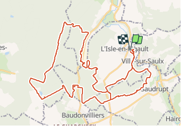
Tocht Mountainbike van 29 km beschikbaar op Grand Est, Meuse, L'Isle-en-Rigault. Deze tocht wordt voorgesteld door Nono55.
Beschrijving
Parcours sympa
Site Ferme de Lombroie magnifique
Retour nombreux singles
Plaatsbepaling
Land:
France
Regio :
Grand Est
Departement/Provincie :
Meuse
Gemeente :
L'Isle-en-Rigault
Locatie:
Unknown
Vertrek:(Dec)
Vertrek:(UTM)
650775 ; 5398023 (31U) N.
Opmerkingen