


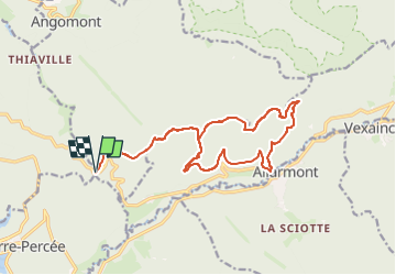
de chapelotte à rocher rambiroche

Titinechris
Gebruiker

Lengte
16,8 km

Max. hoogte
666 m

Positief hoogteverschil
611 m
Km-Effort
25 km

Min. hoogte
347 m

Negatief hoogteverschil
609 m
Boucle
Ja
Datum van aanmaak :
2024-02-11 09:07:07.968
Laatste wijziging :
2024-02-11 09:08:39.559
0m
Moeilijkheid : Gemakkelijk

Gratisgps-wandelapplicatie
 SityTrail
IGN / Geografische instituten
SityTrail Plus
De wereld gaat voor u open
Over ons
Tocht Trail van 16,8 km beschikbaar op Grand Est, Meurthe-et-Moselle, Angomont. Deze tocht wordt voorgesteld door Titinechris.
Plaatsbepaling
Land:
France
Regio :
Grand Est
Departement/Provincie :
Meurthe-et-Moselle
Gemeente :
Angomont
Locatie:
Unknown
Vertrek:(Dec)
Vertrek:(UTM)
348969 ; 5372091 (32U) N.
Opmerkingen