Tocht Te voet Villemoustaussou - Pont Rouge, St Pierre du Trapel, écluses de l'Evêque, Pont Rouge. - Photo

Pont Rouge, St Pierre du Trapel, écluses de l'Evêque, Pont Rouge.

 michelsemulue
michelsemulue

Gebruiker

© OpenStreetMap contributors
Lengte
Lengte
7,6 km
Max. hoogte
Max. hoogte
106 m
Positief hoogteverschil
49 m
Km-Effort
Km-Effort  
8,3 km
Min. hoogte
Min. hoogte
93 m
Negatief hoogteverschil
49 m
Boucle
Boucle
Ja
Datum van aanmaak :
2024-03-22 10:36:02.457
Laatste wijziging :
2024-03-22 10:39:36.322

(0 Bericht)

Te voet
Te voet
1h53
Moeilijkheid : Gemakkelijk

Scan deze QR-code om de tocht te openen in de SityTrail-applicatie

Gratisgps-wandelapplicatie

Logo SityTrail SityTrail

IGN / Geografische instituten

SityTrail uit de App Store downloaden SityTrail uit Google Play downloaden

Logo SityTrail SityTrail World

De wereld gaat voor u open

SityTrail uit de App Store downloaden SityTrail uit Google Play downloaden SityTrail op Huawei AppGallery downloaden

Over ons

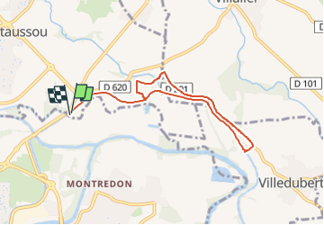
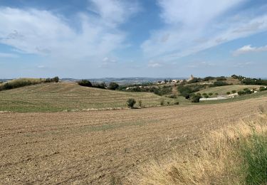
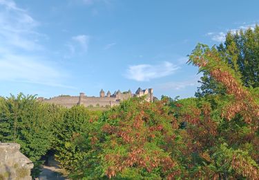
Tocht Te voet van 7,6 km beschikbaar op Occitanië, Aude, Villemoustaussou. Deze tocht wordt voorgesteld door michelsemulue.

Beschrijving

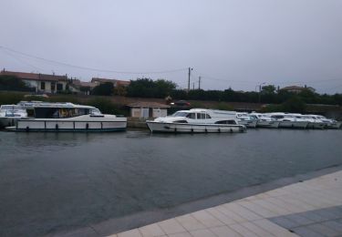
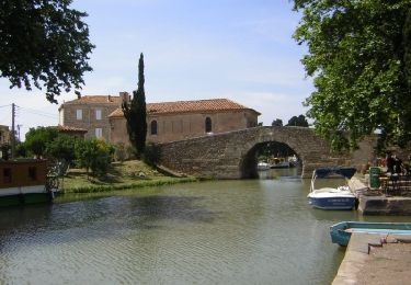
Pont Rouge, La Mijane, St Pierre du Trapel, Ecluse de l'Evêque, Pont Rouge.

Hoogteprofiel

Plaatsbepaling

Land:
France
Regio :
Occitanië
Departement/Provincie :
Aude
Gemeente :
Villemoustaussou
Locatie:
Unknown
Vertrek:(UTM)
449680 ; 4787738 (31T) N.

Wandeltochten in de omgeving

Tocht Stappen Villegly - Wisigoths  - Photo
Stappen
GUIDE
Ada11

Stappen

Gemakkelijk
Villegly, Occitanië, Aude, France
19,7 km | 24 km-effort
4h 37min
Ja
Tocht Stappen Villegailhenc - Villegailhenc Conques Aragon - Photo
Stappen
GUIDE
Ada11

Stappen

Medium
Villegailhenc, Occitanië, Aude, France
23 km | 29 km-effort
5h 45min
Ja
Tocht Stappen Conques-sur-Orbiel - village celte - Photo
Stappen
oliviercaty

Stappen

Gemakkelijk
(1)
Conques-sur-Orbiel, Occitanië, Aude, France
3,9 km | 4,8 km-effort
1h 48min
Ja
Tocht Stappen Villalier - boucle Villalier La Mee les cabanes dans les bois - Photo
Stappen
bernardbelmas

Stappen

Heel gemakkelijk
Villalier, Occitanië, Aude, France
6,8 km | 8,1 km-effort
1h 58min
Ja
Tocht Wegfiets Trèbes - Trèbes - Photo
Wegfiets
FPortier

Wegfiets

Heel gemakkelijk
Trèbes, Occitanië, Aude, France
5 km | 5,7 km-effort
35min
Ja
Tocht Stappen Carcassonne - Berges de l'Aude 17 - Photo
Stappen
DENNEBECQ

Stappen

Heel gemakkelijk
(1)
Carcassonne, Occitanië, Aude, France
5,3 km | 5,7 km-effort
1h 7min
Ja
Tocht Fiets Carcassonne - de carcassonne a frontignan - Photo
Fiets
destras

Fiets

Gemakkelijk
Carcassonne, Occitanië, Aude, France
161 km | 175 km-effort
10h 1min
Neen
Tocht Stappen Carcassonne - 2023 09 15 CHEMIN du PIÉMONT PYRÉNÉEN - 8ème étapes : CARCASSONNE - LAVALETTE - ALAIRAC - ARZENS - MONTRÉAL - VILLENEUVE- lès-Montréal - LASSERE - FANGEAUX - Photo
Stappen
LEGUE

Stappen

Zeer moeilijk
Carcassonne, Occitanië, Aude, France
40 km | 49 km-effort
7h 36min
Neen
Tocht Stappen Carcassonne - carcassonne under the sun  - Photo
Stappen
stef789

Stappen

Gemakkelijk
Carcassonne, Occitanië, Aude, France
7,7 km | 9,2 km-effort
3h 44min
Neen


Sluiten
Mijn abonnementen