![](/images/other/stat-length.png)
![Tocht Stappen Gières - Boucle Mûrier - Venon depuis Gières - Photo](https://media.geolcdn.com/t/1900/400/ext.pjpeg?maxdim=2&url=https%3A%2F%2Fmedia.geolcdn.com%2Ff%2Fc6968e08-c2d2-4d10-9d70-51d89710f0b1.jpg)
Boucle Mûrier - Venon depuis Gières
flip38
Gebruiker
![Lengte](/images/other/stat-length.png)
Lengte
17,9 km
![Max. hoogte](https://static1.geolcdn.com/siteimages/upload/files/1508320355ic_sort_altitude_max_24dp.png)
Max. hoogte
701 m
![Positief hoogteverschil](https://static1.geolcdn.com/siteimages/upload/files/1508320355ic_sort_den_pos_24dp.png)
Positief hoogteverschil
822 m
![Km-Effort](/images/other/stat-length.png)
Km-Effort
29 km
![Min. hoogte](https://static1.geolcdn.com/siteimages/upload/files/1508320355ic_sort_altitude_min_24dp.png)
Min. hoogte
229 m
![Negatief hoogteverschil](https://static1.geolcdn.com/siteimages/upload/files/1508320355ic_sort_den_neg_24dp.png)
Negatief hoogteverschil
822 m
![Boucle](https://static1.geolcdn.com/siteimages/upload/files/16400158638029165_repeat_loop_refresh_sync_direction_icon.png)
Boucle
Ja
Datum van aanmaak :
2024-04-21 10:13:25.319
Laatste wijziging :
2024-04-21 21:06:03.302
![Stappen](https://static1.geolcdn.com/sitytour/trail-icons/101.png)
4h10
Moeilijkheid : Medium
![Scan deze QR-code om de tocht te openen in de SityTrail-applicatie](https://capi.geolives.com/qq0zvz2zws4bq2lad0pu/sitytour/trails/4024578/qr.png?size=200)
Gratisgps-wandelapplicatie
Over ons
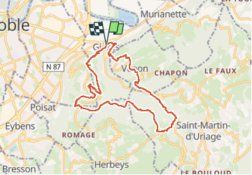
Tocht Stappen van 17,9 km beschikbaar op Auvergne-Rhône-Alpes, Isère, Gières. Deze tocht wordt voorgesteld door flip38.
Beschrijving
Boucle assez longue mais qui relie les deux versants de la combe de Gières.
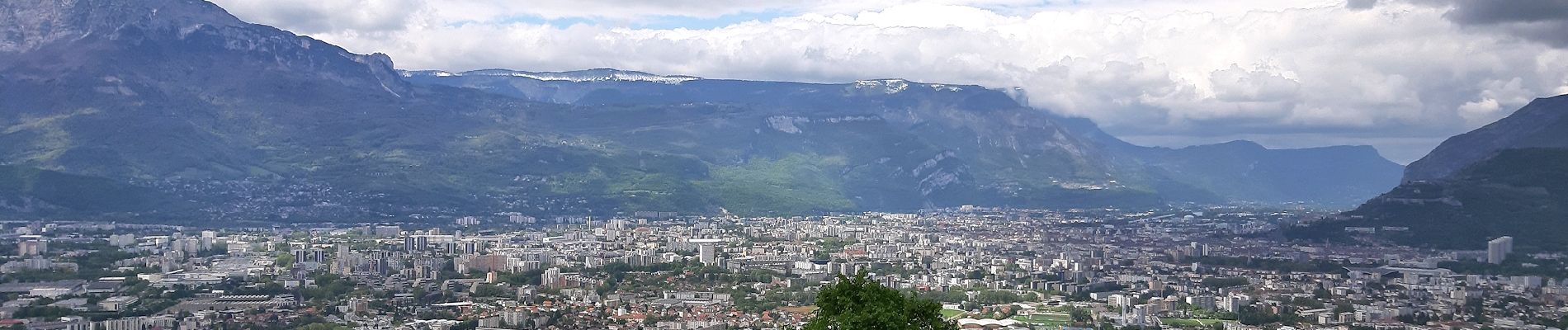
Chemins ou sentiers souvent en forêt, quelques parties en bitume mais pas très longues. De beaux points de vue sur le bassin grenoblois.
On passera aussi par certaines fortifications du Mûrier.
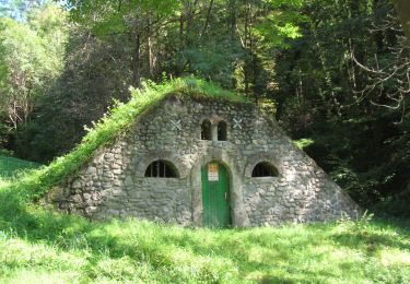
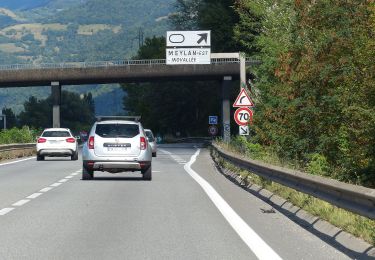
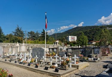
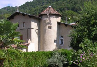
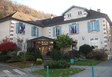
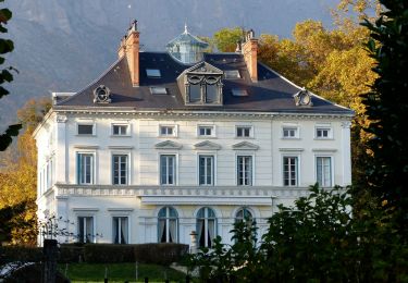
Plaatsbepaling
Land:
France
Regio :
Auvergne-Rhône-Alpes
Departement/Provincie :
Isère
Gemeente :
Gières
Locatie:
Unknown
Vertrek:(Dec)
Vertrek:(UTM)
719267 ; 5006820 (31T) N.
Opmerkingen
Wandeltochten in de omgeving
![Tocht Te voet Saint-Martin-d'Uriage - Circuit des Curistes - Photo](https://media.geolcdn.com/t/375/260/ext.jpg?maxdim=2&url=https%3A%2F%2Fmedia.geolcdn.com%2Ff%2F884736af-6d5e-4498-9816-404871d42486.jpeg)
![Te voet Te voet](https://static1.geolcdn.com/sitytour/trail-icons/100.png)
Circuit des Curistes
Te voet
Gemakkelijk
Saint-Martin-d'Uriage,
Auvergne-Rhône-Alpes,
Isère,
France
![](/images/other/stat-length.png)
5,9 km | 7,8 km-effort
1h 46min
![](https://static1.geolcdn.com/siteimages/upload/files/16400158638029165_repeat_loop_refresh_sync_direction_icon.png)
Ja
![Tocht Te voet Saint-Martin-d'Uriage - Circuit des Crêtes - Photo](https://media.geolcdn.com/t/375/260/ext.jpg?maxdim=2&url=https%3A%2F%2Fmedia.geolcdn.com%2Ff%2Fa077f9fa-48e4-483f-a273-f9f858afd6d0.jpeg)
![Te voet Te voet](https://static1.geolcdn.com/sitytour/trail-icons/100.png)
Circuit des Crêtes
Te voet
Gemakkelijk
Saint-Martin-d'Uriage,
Auvergne-Rhône-Alpes,
Isère,
France
![](/images/other/stat-length.png)
9,5 km | 13,6 km-effort
3h 5min
![](https://static1.geolcdn.com/siteimages/upload/files/16400158638029165_repeat_loop_refresh_sync_direction_icon.png)
Ja
![Tocht Te voet Saint-Martin-d'Uriage - Circuit du Bit - Photo](https://media.geolcdn.com/t/375/260/ext.jpg?maxdim=2&url=https%3A%2F%2Fmedia.geolcdn.com%2Ff%2F2fa5dbdf-0fcb-48b8-a2a0-bdb0f129de25.jpeg)
![Te voet Te voet](https://static1.geolcdn.com/sitytour/trail-icons/100.png)
Circuit du Bit
Te voet
Gemakkelijk
Saint-Martin-d'Uriage,
Auvergne-Rhône-Alpes,
Isère,
France
![](/images/other/stat-length.png)
9,1 km | 16,3 km-effort
3h 41min
![](https://static1.geolcdn.com/siteimages/upload/files/16400158638029165_repeat_loop_refresh_sync_direction_icon.png)
Ja
![Tocht Te voet Saint-Martin-d'Uriage - Balcon de Combeloup - Photo](https://media.geolcdn.com/t/375/260/ext.jpg?maxdim=2&url=https%3A%2F%2Fmedia.geolcdn.com%2Ff%2F67f211a9-4659-4ac8-8551-19ac88e52f68.jpeg)
![Te voet Te voet](https://static1.geolcdn.com/sitytour/trail-icons/100.png)
Balcon de Combeloup
Te voet
Gemakkelijk
Saint-Martin-d'Uriage,
Auvergne-Rhône-Alpes,
Isère,
France
![](/images/other/stat-length.png)
9,4 km | 15,1 km-effort
3h 25min
![](https://static1.geolcdn.com/siteimages/upload/files/16400158638029165_repeat_loop_refresh_sync_direction_icon.png)
Ja
![Tocht Te voet Domène - Domène à Murianette, par les rives de l'Isère - Photo](https://media.geolcdn.com/t/375/260/ext.jpg?maxdim=2&url=https%3A%2F%2Fmedia.geolcdn.com%2Ff%2Ff00f3b3d-abcc-47f4-9cc6-e5ee52a8ddd2.jpeg)
![Te voet Te voet](https://static1.geolcdn.com/sitytour/trail-icons/100.png)
Domène à Murianette, par les rives de l'Isère
Te voet
Gemakkelijk
Domène,
Auvergne-Rhône-Alpes,
Isère,
France
![](/images/other/stat-length.png)
6,4 km | 7 km-effort
1h 35min
![](https://static1.geolcdn.com/siteimages/upload/files/16400158638029165_repeat_loop_refresh_sync_direction_icon.png)
Neen
![Tocht Te voet Domène - Circuit de Beauregard - Photo](https://media.geolcdn.com/t/375/260/ext.jpg?maxdim=2&url=https%3A%2F%2Fmedia.geolcdn.com%2Ff%2Fc0d86b6a-ec41-4f3c-879d-1fb6f4151878.jpeg)
![Te voet Te voet](https://static1.geolcdn.com/sitytour/trail-icons/100.png)
Circuit de Beauregard
Te voet
Gemakkelijk
Domène,
Auvergne-Rhône-Alpes,
Isère,
France
![](/images/other/stat-length.png)
3,6 km | 7 km-effort
1h 35min
![](https://static1.geolcdn.com/siteimages/upload/files/16400158638029165_repeat_loop_refresh_sync_direction_icon.png)
Ja
![Tocht Te voet Domène - Circuit de la Monta - Photo](https://media.geolcdn.com/t/375/260/ext.jpg?maxdim=2&url=https%3A%2F%2Fmedia.geolcdn.com%2Ff%2F8f502881-e98d-4929-b19b-6c8e9cb279e5.jpeg)
![Te voet Te voet](https://static1.geolcdn.com/sitytour/trail-icons/100.png)
Circuit de la Monta
Te voet
Gemakkelijk
Domène,
Auvergne-Rhône-Alpes,
Isère,
France
![](/images/other/stat-length.png)
9,9 km | 15,4 km-effort
3h 29min
![](https://static1.geolcdn.com/siteimages/upload/files/16400158638029165_repeat_loop_refresh_sync_direction_icon.png)
Ja
![Tocht Te voet Gières - De Gières au col du Gourlu - Photo](https://media.geolcdn.com/t/375/260/ext.jpg?maxdim=2&url=https%3A%2F%2Fmedia.geolcdn.com%2Ff%2Fb782ea79-2f14-452c-9af6-76dad2fec664.jpeg)
![Te voet Te voet](https://static1.geolcdn.com/sitytour/trail-icons/100.png)
De Gières au col du Gourlu
Te voet
Gemakkelijk
Gières,
Auvergne-Rhône-Alpes,
Isère,
France
![](/images/other/stat-length.png)
6,2 km | 10,5 km-effort
2h 22min
![](https://static1.geolcdn.com/siteimages/upload/files/16400158638029165_repeat_loop_refresh_sync_direction_icon.png)
Neen
![Tocht Te voet La Tronche - Grande Traverse de Meylan - Photo](https://media.geolcdn.com/t/375/260/ext.jpg?maxdim=2&url=https%3A%2F%2Fmedia.geolcdn.com%2Ff%2F07dafc4a-0388-404d-b349-5b51404ed80b.jpeg)
![Te voet Te voet](https://static1.geolcdn.com/sitytour/trail-icons/100.png)
Grande Traverse de Meylan
Te voet
Gemakkelijk
La Tronche,
Auvergne-Rhône-Alpes,
Isère,
France
![](/images/other/stat-length.png)
5,6 km | 6,5 km-effort
1h 28min
![](https://static1.geolcdn.com/siteimages/upload/files/16400158638029165_repeat_loop_refresh_sync_direction_icon.png)
Neen