


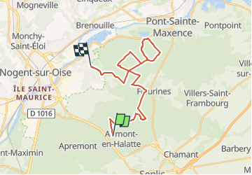
VTT Aumont - Verneuil

christianH
Gebruiker

Lengte
24 km

Max. hoogte
148 m

Positief hoogteverschil
286 m
Km-Effort
28 km

Min. hoogte
38 m

Negatief hoogteverschil
352 m
Boucle
Neen
Datum van aanmaak :
2024-05-10 12:01:38.139
Laatste wijziging :
2024-05-10 12:02:19.625
1h57
Moeilijkheid : Medium

Gratisgps-wandelapplicatie
 SityTrail
IGN / Geografische instituten
SityTrail Plus
De wereld gaat voor u open
Over ons
Tocht Mountainbike van 24 km beschikbaar op Hauts-de-France, Oise, Aumont-en-Halatte. Deze tocht wordt voorgesteld door christianH.
Plaatsbepaling
Land:
France
Regio :
Hauts-de-France
Departement/Provincie :
Oise
Gemeente :
Aumont-en-Halatte
Locatie:
Unknown
Vertrek:(Dec)
Vertrek:(UTM)
466970 ; 5453221 (31U) N.
Opmerkingen