


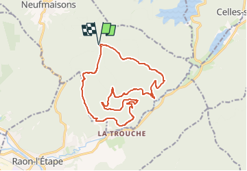
tour des roches vannes, cherpierre, arcades

Titinechris
Gebruiker

Lengte
16,8 km

Max. hoogte
524 m

Positief hoogteverschil
568 m
Km-Effort
24 km

Min. hoogte
298 m

Negatief hoogteverschil
568 m
Boucle
Ja
Datum van aanmaak :
2024-05-26 06:07:52.154
Laatste wijziging :
2024-05-26 06:11:13.671
0m
Moeilijkheid : Medium

Gratisgps-wandelapplicatie
 SityTrail
IGN / Geografische instituten
SityTrail Plus
De wereld gaat voor u open
Over ons
Tocht Trail van 16,8 km beschikbaar op Grand Est, Meurthe-et-Moselle, Neufmaisons. Deze tocht wordt voorgesteld door Titinechris.
Plaatsbepaling
Land:
France
Regio :
Grand Est
Departement/Provincie :
Meurthe-et-Moselle
Gemeente :
Neufmaisons
Locatie:
Unknown
Vertrek:(Dec)
Vertrek:(UTM)
342821 ; 5368027 (32U) N.
Opmerkingen