


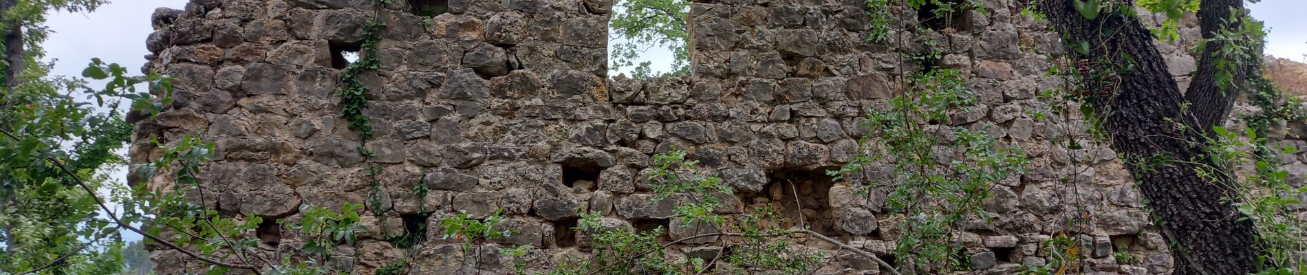
Callian, ruines de Velnasque

Pascal-83
Gebruiker
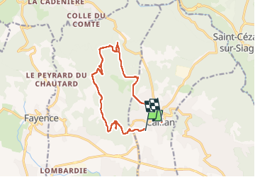

Lengte
13,7 km

Max. hoogte
462 m

Positief hoogteverschil
375 m
Km-Effort
18,3 km

Min. hoogte
221 m

Negatief hoogteverschil
269 m
Boucle
Neen
Datum van aanmaak :
2024-06-04 06:57:57.892
Laatste wijziging :
2024-06-04 13:00:02.908
6h01
Moeilijkheid : Medium

Gratisgps-wandelapplicatie
 SityTrail
IGN / Geografische instituten
SityTrail Plus
De wereld gaat voor u open
Over ons
Tocht Stappen van 13,7 km beschikbaar op Provence-Alpes-Côte d'Azur, Var, Callian. Deze tocht wordt voorgesteld door Pascal-83.
Beschrijving
Callian, Vallon de la Camiole
Foto's


Plaatsbepaling
Land:
France
Regio :
Provence-Alpes-Côte d'Azur
Departement/Provincie :
Var
Gemeente :
Callian
Locatie:
Unknown
Vertrek:(Dec)
Vertrek:(UTM)
318098 ; 4832091 (32T) N.
Opmerkingen