


2024 08 11 Bellême Foret

chlafaille
Gebruiker

Lengte
8,3 km

Max. hoogte
254 m

Positief hoogteverschil
147 m
Km-Effort
10,3 km

Min. hoogte
176 m

Negatief hoogteverschil
147 m
Boucle
Ja
Datum van aanmaak :
2024-08-11 06:55:40.685
Laatste wijziging :
2024-08-11 16:10:58.937
1h50
Moeilijkheid : Gemakkelijk

Gratisgps-wandelapplicatie
 SityTrail
IGN / Geografische instituten
SityTrail Plus
De wereld gaat voor u open
Over ons
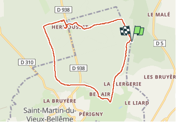
Tocht Stappen van 8,3 km beschikbaar op Normandië, Orne, Belforêt-en-Perche. Deze tocht wordt voorgesteld door chlafaille.
Plaatsbepaling
Land:
France
Regio :
Normandië
Departement/Provincie :
Orne
Gemeente :
Belforêt-en-Perche
Locatie:
Sérigny
Vertrek:(Dec)
Vertrek:(UTM)
320359 ; 5363496 (31U) N.
Opmerkingen