


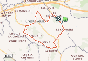
2024-08-23 Rando Cresseveuille + Café du Rocher

jchezlemas
Gebruiker

Lengte
8 km

Max. hoogte
131 m

Positief hoogteverschil
131 m
Km-Effort
9,7 km

Min. hoogte
52 m

Negatief hoogteverschil
133 m
Boucle
Ja
Datum van aanmaak :
2024-08-23 07:57:29.084
Laatste wijziging :
2024-08-23 13:36:53.553
2h09
Moeilijkheid : Gemakkelijk

Gratisgps-wandelapplicatie
 SityTrail
IGN / Geografische instituten
SityTrail Plus
De wereld gaat voor u open
Over ons
Tocht Stappen van 8 km beschikbaar op Normandië, Calvados, Danestal. Deze tocht wordt voorgesteld door jchezlemas.
Plaatsbepaling
Land:
France
Regio :
Normandië
Departement/Provincie :
Calvados
Gemeente :
Danestal
Locatie:
Unknown
Vertrek:(Dec)
Vertrek:(UTM)
283728 ; 5458316 (31U) N.
Opmerkingen