


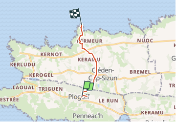
GR34 Plogoff Brezelec

thonyc
Gebruiker GUIDE

Lengte
6,4 km

Max. hoogte
79 m

Positief hoogteverschil
94 m
Km-Effort
7,7 km

Min. hoogte
17 m

Negatief hoogteverschil
98 m
Boucle
Neen
Datum van aanmaak :
2024-09-01 13:25:54.651
Laatste wijziging :
2024-09-01 13:25:57.217
1h44
Moeilijkheid : Gemakkelijk

Gratisgps-wandelapplicatie
 SityTrail
IGN / Geografische instituten
SityTrail Plus
De wereld gaat voor u open
Over ons
Tocht Stappen van 6,4 km beschikbaar op Bretagne, Finistère, Plogoff. Deze tocht wordt voorgesteld door thonyc.
Plaatsbepaling
Land:
France
Regio :
Bretagne
Departement/Provincie :
Finistère
Gemeente :
Plogoff
Locatie:
Unknown
Vertrek:(Dec)
Vertrek:(UTM)
375942 ; 5321806 (30U) N.
Opmerkingen