


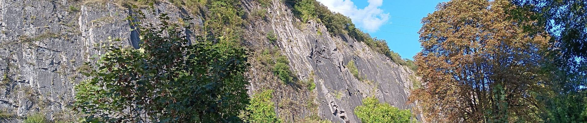
ambleve . pic de Napoléon . roches noires . ourthe

stef789
Gebruiker GUIDE
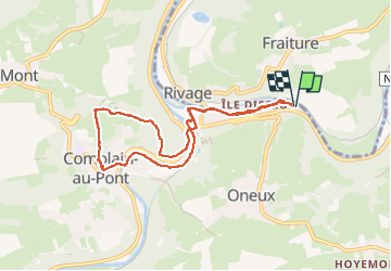

Lengte
7,3 km

Max. hoogte
189 m

Positief hoogteverschil
140 m
Km-Effort
9,2 km

Min. hoogte
95 m

Negatief hoogteverschil
141 m
Boucle
Ja
Datum van aanmaak :
2024-09-11 13:07:56.599
Laatste wijziging :
2024-09-11 15:39:37.249
2h31
Moeilijkheid : Gemakkelijk

Gratisgps-wandelapplicatie
 SityTrail
IGN / Geografische instituten
SityTrail Plus
De wereld gaat voor u open
Over ons
Tocht Stappen van 7,3 km beschikbaar op Wallonië, Luik, Comblain-au-Pont. Deze tocht wordt voorgesteld door stef789.
Foto's


26 fotos in totaal. Klik op een foto om ze allemaal in de galerij weer te geven.
Plaatsbepaling
Land:
Belgium
Regio :
Wallonië
Departement/Provincie :
Luik
Gemeente :
Comblain-au-Pont
Locatie:
Unknown
Vertrek:(Dec)
Vertrek:(UTM)
684856 ; 5595461 (31U) N.
Opmerkingen