


Sob 15 bellebouche nuret le ferron

Glurps
Gebruiker
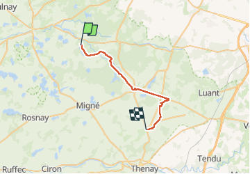

Lengte
27 km

Max. hoogte
156 m

Positief hoogteverschil
163 m
Km-Effort
29 km

Min. hoogte
104 m

Negatief hoogteverschil
125 m
Boucle
Neen
Datum van aanmaak :
2024-09-26 06:15:14.0
Laatste wijziging :
2024-09-26 17:03:39.987

Gratisgps-wandelapplicatie
 SityTrail
IGN / Geografische instituten
SityTrail Plus
De wereld gaat voor u open
Over ons
Tocht van 27 km beschikbaar op Centre-Val de Loire, Indre, Mézières-en-Brenne. Deze tocht wordt voorgesteld door Glurps.
Plaatsbepaling
Land:
France
Regio :
Centre-Val de Loire
Departement/Provincie :
Indre
Gemeente :
Mézières-en-Brenne
Locatie:
Unknown
Vertrek:(Dec)
Vertrek:(UTM)
370618 ; 5184154 (31T) N.
Opmerkingen