


riboux de daniel

Coryphene
Gebruiker
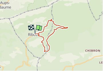

Lengte
12,4 km

Max. hoogte
624 m

Positief hoogteverschil
271 m
Km-Effort
16 km

Min. hoogte
499 m

Negatief hoogteverschil
271 m
Boucle
Ja
Datum van aanmaak :
2024-10-03 07:47:26.132
Laatste wijziging :
2024-10-03 13:16:04.359
3h39
Moeilijkheid : Moeilijk

Gratisgps-wandelapplicatie
 SityTrail
IGN / Geografische instituten
SityTrail Plus
De wereld gaat voor u open
Over ons
Tocht Stappen van 12,4 km beschikbaar op Provence-Alpes-Côte d'Azur, Var, Riboux. Deze tocht wordt voorgesteld door Coryphene.
Plaatsbepaling
Land:
France
Regio :
Provence-Alpes-Côte d'Azur
Departement/Provincie :
Var
Gemeente :
Riboux
Locatie:
Unknown
Vertrek:(Dec)
Vertrek:(UTM)
723693 ; 4798226 (31T) N.
Opmerkingen