


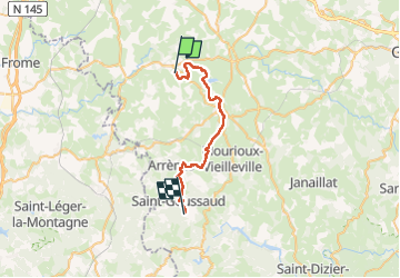
Sob 22 chamborand saint goussaud

Glurps
Gebruiker

Lengte
29 km

Max. hoogte
673 m

Positief hoogteverschil
794 m
Km-Effort
39 km

Min. hoogte
380 m

Negatief hoogteverschil
639 m
Boucle
Neen
Datum van aanmaak :
2024-10-04 06:38:42.0
Laatste wijziging :
2024-10-04 18:57:26.69

Gratisgps-wandelapplicatie
 SityTrail
IGN / Geografische instituten
SityTrail Plus
De wereld gaat voor u open
Over ons
Tocht van 29 km beschikbaar op Nieuw-Aquitanië, Creuse, Chamborand. Deze tocht wordt voorgesteld door Glurps.
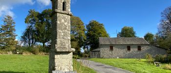
Foto's


Plaatsbepaling
Land:
France
Regio :
Nieuw-Aquitanië
Departement/Provincie :
Creuse
Gemeente :
Chamborand
Locatie:
Unknown
Vertrek:(Dec)
Vertrek:(UTM)
389833 ; 5111792 (31T) N.
Opmerkingen