


wex ac 2

colsonandre
Gebruiker
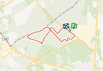

Lengte
5,8 km

Max. hoogte
224 m

Positief hoogteverschil
56 m
Km-Effort
6,6 km

Min. hoogte
191 m

Negatief hoogteverschil
60 m
Boucle
Ja
Datum van aanmaak :
2024-12-16 12:49:07.087
Laatste wijziging :
2024-12-16 14:51:18.284
2h01
Moeilijkheid : Medium

Gratisgps-wandelapplicatie
 SityTrail
IGN / Geografische instituten
SityTrail Plus
De wereld gaat voor u open
Over ons
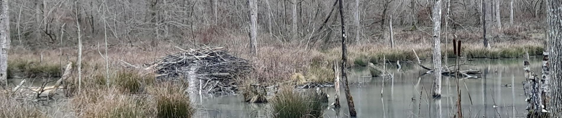
Tocht Stappen van 5,8 km beschikbaar op Wallonië, Luxemburg, Marche-en-Famenne. Deze tocht wordt voorgesteld door colsonandre.
Foto's


Plaatsbepaling
Land:
Belgium
Regio :
Wallonië
Departement/Provincie :
Luxemburg
Gemeente :
Marche-en-Famenne
Locatie:
Unknown
Vertrek:(Dec)
Vertrek:(UTM)
666095 ; 5568410 (31U) N.
Opmerkingen