


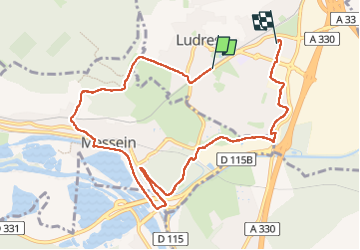
ludres messein boucle

ISAGIL
Gebruiker

Lengte
9,3 km

Max. hoogte
384 m

Positief hoogteverschil
197 m
Km-Effort
12 km

Min. hoogte
218 m

Negatief hoogteverschil
214 m
Boucle
Neen
Datum van aanmaak :
2025-01-07 12:33:12.467
Laatste wijziging :
2025-01-07 16:00:36.387
3h26
Moeilijkheid : Medium

Gratisgps-wandelapplicatie
 SityTrail
IGN / Geografische instituten
SityTrail Plus
De wereld gaat voor u open
Over ons
Tocht Stappen van 9,3 km beschikbaar op Grand Est, Meurthe-et-Moselle, Ludres. Deze tocht wordt voorgesteld door ISAGIL.
Beschrijving
ludres messein
Plaatsbepaling
Land:
France
Regio :
Grand Est
Departement/Provincie :
Meurthe-et-Moselle
Gemeente :
Ludres
Locatie:
Unknown
Vertrek:(Dec)
Vertrek:(UTM)
290948 ; 5388922 (32U) N.
Opmerkingen