


connexion-theux-stoumont-theux

Efr
Gebruiker

Lengte
15,4 km

Max. hoogte
481 m

Positief hoogteverschil
456 m
Km-Effort
21 km

Min. hoogte
156 m

Negatief hoogteverschil
456 m
Boucle
Ja
Datum van aanmaak :
2025-01-20 21:27:33.194
Laatste wijziging :
2025-06-08 15:40:02.377
4h52
Moeilijkheid : Zeer moeilijk

Gratisgps-wandelapplicatie
 SityTrail
IGN / Geografische instituten
SityTrail Plus
De wereld gaat voor u open
Over ons
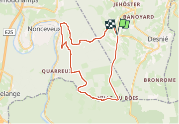
Tocht Stappen van 15,4 km beschikbaar op Wallonië, Luik, Theux. Deze tocht wordt voorgesteld door Efr.
Beschrijving
Depart : Vert-Buisson
4910 Theux
Plaatsbepaling
Land:
Belgium
Regio :
Wallonië
Departement/Provincie :
Luik
Gemeente :
Theux
Locatie:
La Reid
Vertrek:(Dec)
Vertrek:(UTM)
697496 ; 5593888 (31U) N.
Opmerkingen