Tocht Stappen Canet-en-Roussillon - CANET-EN-ROUSSILLON 66 - entre TÊT, marais. étang et RÉART  - Photo

CANET-EN-ROUSSILLON 66 - entre TÊT, marais. étang et RÉART

 jeff66
jeff66

Gebruiker

© OpenStreetMap contributors
Lengte
Lengte
16,3 km
Max. hoogte
Max. hoogte
13 m
Positief hoogteverschil
89 m
Km-Effort
Km-Effort  
17,5 km
Min. hoogte
Min. hoogte
-3 m
Negatief hoogteverschil
90 m
Boucle
Boucle
Ja
Datum van aanmaak :
2015-06-28 00:00:00.0
Laatste wijziging :
2015-06-28 00:00:00.0

(1 Bericht)

Stappen
Stappen
2h49
Moeilijkheid : Medium

Scan deze QR-code om de tocht te openen in de SityTrail-applicatie

Gratisgps-wandelapplicatie

Logo SityTrail SityTrail

IGN / Geografische instituten

SityTrail uit de App Store downloaden SityTrail uit Google Play downloaden

Logo SityTrail SityTrail World

De wereld gaat voor u open

SityTrail uit de App Store downloaden SityTrail uit Google Play downloaden SityTrail op Huawei AppGallery downloaden

Over ons

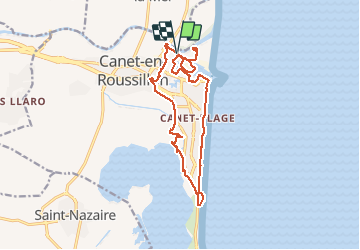
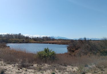
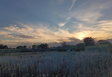
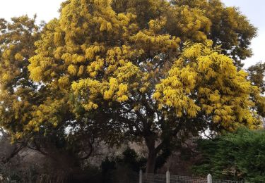
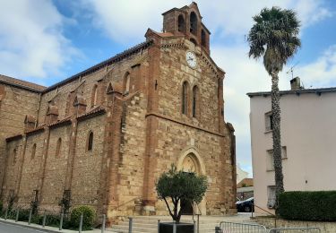
Tocht Stappen van 16,3 km beschikbaar op Occitanië, Pyrénées-Orientales, Canet-en-Roussillon. Deze tocht wordt voorgesteld door jeff66.

Beschrijving

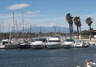
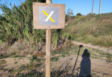
CANET-EN-ROUSSILLON 66 - bord de TÊT - passage sous le pont de la D81 enjambant la têt -  la bombarda - quartier du Ponant - restaurant le petit chez soi - rue du génois - au bout monter les escaliers - centre commercial - complexe la Luna - la colline des loisirs - passage piéton sous terrain sous D61-7 - voie cycliste -  entre prairie et marais - chemin entre marais et D81A - château de l'Esparrou - vignoble du château - El Cap Del Rec - observatoire de l'Esparrou_les baraques - camping Mar Estang - piste cyclable - hôtel les flamants roses thalasso CANET SUD - plage - promenade Charles TRENET - Estelle de Mar plage restaurant - résidences Grand Sud, Beaupré - Carré Bleu - Kiaora - les terrasses du levant - allée de palmiers Phoenix - front de mer. - paradisio - la Marenda - le soleil bleu - mini golf - parking font cote Vermeille - Tahiti Beach - restaurant l'hacienda - Casino Joa - CANET-PLAGE - Gondolys - club Paréo restaurant de plage   Côté plage - parking Ajaccio - capitainerie - port de plaisance - bassins Le Gouffre et des marinas - gendarmerie nationale - voie Florence Arthaud - vieux gréements - lycée Eva Luxembourg - gymnase Eric Tabarly - pôle nautique - El Gorg - campings les peupliers, Brasilia, le Bosquet - Carrera Vella - aire de carénage -

Hoogteprofiel

Foto's

30 fotos in totaal. Klik op een foto om ze allemaal in de galerij weer te geven.

Plaatsbepaling

Land:
France
Regio :
Occitanië
Departement/Provincie :
Pyrénées-Orientales
Gemeente :
Canet-en-Roussillon
Locatie:
Unknown
Vertrek:(Dec)
Vertrek:(UTM)
502149 ; 4728449 (31T) N.

Opmerkingen

Gelieve in te loggen om een commentaar of een beoordeling achter te laten


Wandeltochten in de omgeving

Tocht Stappen Sainte-Marie-la-Mer - 66 SAINTE-MARIE-LA-MER - à Sainte-Marie plage par la SALANQUE, la TÊT, le port le front de mer, et les canaux  - Photo
Stappen
jeff66

Stappen

Medium
(1)
Sainte-Marie-la-Mer, Occitanië, Pyrénées-Orientales, France
12,1 km | 12,6 km-effort
2h 0min
Ja
Tocht Stappen Saint-Nazaire - 66 SAINT-NAZAIRE - CABESTANY promenade dans le vignoble de galets - Photo
Stappen
jeff66

Stappen

Medium
Saint-Nazaire, Occitanië, Pyrénées-Orientales, France
9 km | 9,9 km-effort
1h 29min
Ja
Tocht Stappen Canet-en-Roussillon - CANET-EN-ROUSSILLON 66 - entre mer, plage, dunes et étang - SAINT-CYPRIEN-PLAGE - Photo
Stappen
jeff66

Stappen

Medium
Canet-en-Roussillon, Occitanië, Pyrénées-Orientales, France
12,5 km | 12,9 km-effort
2h 14min
Ja
Tocht Stappen Sainte-Marie-la-Mer - sainte marie la mer - village et plage  - Photo
Stappen
stef789

Stappen

Gemakkelijk
Sainte-Marie-la-Mer, Occitanië, Pyrénées-Orientales, France
8,6 km | 8,9 km-effort
2h 40min
Ja
Tocht Stappen Sainte-Marie-la-Mer - sainte Marie la mer HUIT KM plus retour en voiture oups désolé  - Photo
Stappen
stef789

Stappen

Zeer moeilijk
Sainte-Marie-la-Mer, Occitanië, Pyrénées-Orientales, France
45 km | 49 km-effort
4h 18min
Neen
Tocht Stappen Sainte-Marie-la-Mer - sainte-marie côté mer  - Photo
Stappen
stef789

Stappen

Heel gemakkelijk
Sainte-Marie-la-Mer, Occitanië, Pyrénées-Orientales, France
8,4 km | 8,7 km-effort
2h 45min
Ja
Tocht Stappen Saint-Nazaire - st nazaire - Photo
Stappen
66Gribouille83

Stappen

Medium
Saint-Nazaire, Occitanië, Pyrénées-Orientales, France
8,5 km | 9,1 km-effort
2h 57min
Ja
Tocht Stappen Sainte-Marie-la-Mer - tour de ste Marie la mer  - Photo
Stappen
junique

Stappen

Heel gemakkelijk
Sainte-Marie-la-Mer, Occitanië, Pyrénées-Orientales, France
5,7 km | 6 km-effort
1h 19min
Ja
Tocht Stappen Saint-Nazaire - st Nazaire  - Photo
Stappen
rosemarie

Stappen

Medium
(1)
Saint-Nazaire, Occitanië, Pyrénées-Orientales, France
6,9 km | 7,3 km-effort
1h 50min
Neen


Sluiten
Mijn abonnementen