


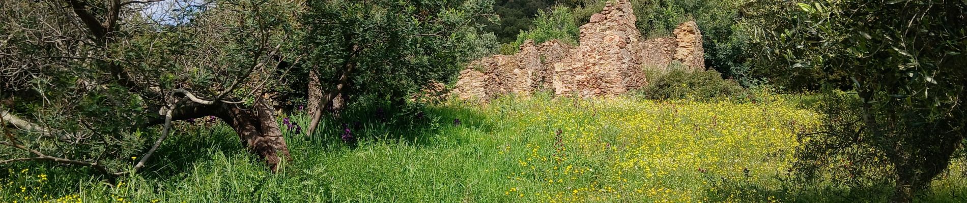
Les Issambres , ruines de Roqueyrol

Pascal-83
Gebruiker

Lengte
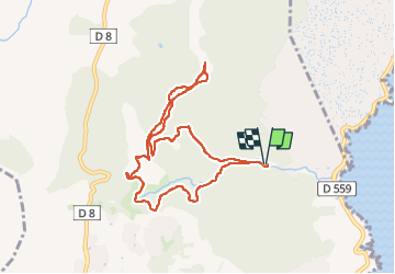
9 km

Max. hoogte
247 m

Positief hoogteverschil
271 m
Km-Effort
12,6 km

Min. hoogte
16 m

Negatief hoogteverschil
271 m
Boucle
Ja
Datum van aanmaak :
2025-04-10 06:22:44.385
Laatste wijziging :
2025-04-10 09:37:11.093
3h14
Moeilijkheid : Medium

Gratisgps-wandelapplicatie
 SityTrail
IGN / Geografische instituten
SityTrail Plus
De wereld gaat voor u open
Over ons
Tocht Stappen van 9 km beschikbaar op Provence-Alpes-Côte d'Azur, Var, Roquebrune-sur-Argens. Deze tocht wordt voorgesteld door Pascal-83.
Beschrijving
marche Roquebrune Amitié
Foto's


Plaatsbepaling
Land:
France
Regio :
Provence-Alpes-Côte d'Azur
Departement/Provincie :
Var
Gemeente :
Roquebrune-sur-Argens
Locatie:
Unknown
Vertrek:(Dec)
Vertrek:(UTM)
313771 ; 4804333 (32T) N.
Opmerkingen