


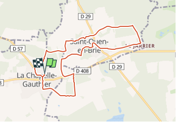
77L26/18 La Chapelle Gauthier - St Ouen en Brie - Forêt de Villefermoy - 20 km Par Thierry IBP 50

jeanmarcMasson
Gebruiker GUIDE


2h26
Moeilijkheid : Medium

Gratisgps-wandelapplicatie
 SityTrail
IGN / Geografische instituten
SityTrail Plus
De wereld gaat voor u open
Over ons
Tocht Stappen van 9,4 km beschikbaar op Île-de-France, Seine-et-Marne, La Chapelle-Gauthier. Deze tocht wordt voorgesteld door jeanmarcMasson.
Beschrijving
[img]https://4.bp.blogspot.com/-CBUmrUw11Uo/Wtr_c5QVTSI/AAAAAAAAPL4/18f8zkojvuQ3yH17tt2Md3CAeGiWpXpOQCLcBGAs/s1600/RONG-ConvertImage.icoo[/img] [b]Rando Club Yerrois[/b]
[img]https://4.bp.blogspot.com/-CBUmrUw11Uo/Wtr_c5QVTSI/AAAAAAAAPL4/18f8zkojvuQ3yH17tt2Md3CAeGiWpXpOQCLcBGAs/s1600/RONG-ConvertImage.icoo[/img] [b]Rando Club Yerrois[/b]
[b]Date[/b] : Mercredi 16 Mai 2018
[b]Animateur[/b] : Thierry
[b]Groupe[/b] : 18-22 km
[b]Effectif[/b] : 28
[b]Relive[/b] :[url]https://youtu.be/xhNk1qV2j38[/url]
[b]Remarque particulière[/b] : Randonnée très variée - Attention beaucoup d'étangs et de points d'eau donc possibilité de passages très boueux. En dehors de cela aucune difficultés particulières. Château et église de la Chapelle Gauthier à voir
[b]Avertissement[/b] Toutes les randonnées répertoriées dans la randothèque du [b]R[/b]ando [b]C[/b]lub [b]Y[/b]errois ont été tracées par l'un de nos animateurs, puis reconnues et enfin effectuées avec un groupe. Pour votre sécurité, regardez toujours la date à laquelle la sortie a été effectuée - Nous tachons de mentionner des conditions météos particulières ou les difficultés éventuelles. N'oubliez jamais les consignes élémentaires de sécurité.
Plaatsbepaling
Opmerkingen