


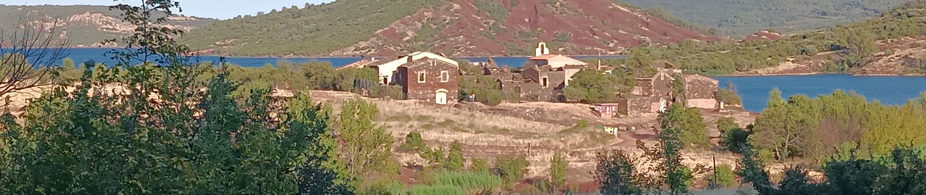
on est allé a Celles ...

stef789
Gebruiker GUIDE
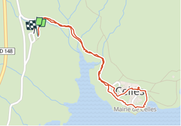

Lengte
1,4 km

Max. hoogte
156 m

Positief hoogteverschil
18 m
Km-Effort
1,6 km

Min. hoogte
138 m

Negatief hoogteverschil
18 m
Boucle
Ja
Datum van aanmaak :
2025-07-31 16:58:31.598
Laatste wijziging :
2025-07-31 17:31:10.728
32m
Moeilijkheid : Gemakkelijk

Gratisgps-wandelapplicatie
 SityTrail
IGN / Geografische instituten
SityTrail Plus
De wereld gaat voor u open
Over ons
Tocht Stappen van 1,4 km beschikbaar op Occitanië, Hérault, Celles. Deze tocht wordt voorgesteld door stef789.
Foto's


Plaatsbepaling
Land:
France
Regio :
Occitanië
Departement/Provincie :
Hérault
Gemeente :
Celles
Locatie:
Unknown
Vertrek:(Dec)
Vertrek:(UTM)
527141 ; 4834542 (31T) N.
Opmerkingen