


5km Bonneuil-Matours

kipoura
Gebruiker

Lengte
5,2 km

Max. hoogte
63 m

Positief hoogteverschil
23 m
Km-Effort
5,5 km

Min. hoogte
53 m

Negatief hoogteverschil
25 m
Boucle
Ja
Datum van aanmaak :
2019-05-03 17:09:58.573
Laatste wijziging :
2019-05-03 17:09:58.611
25m
Moeilijkheid : Onbekend

Gratisgps-wandelapplicatie
 SityTrail
IGN / Geografische instituten
SityTrail Plus
De wereld gaat voor u open
Over ons
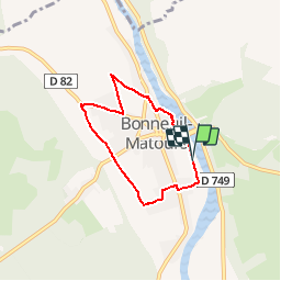
Tocht Lopen van 5,2 km beschikbaar op Nieuw-Aquitanië, Vienne, Bonneuil-Matours. Deze tocht wordt voorgesteld door kipoura.
Plaatsbepaling
Land:
France
Regio :
Nieuw-Aquitanië
Departement/Provincie :
Vienne
Gemeente :
Bonneuil-Matours
Locatie:
Unknown
Vertrek:(Dec)
Vertrek:(UTM)
314561 ; 5172308 (31T) N.
Opmerkingen