


GTMC 2nde partie

PhilippeC54
Gebruiker
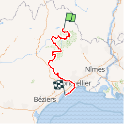

Lengte
347 km

Max. hoogte
1561 m

Positief hoogteverschil
7507 m
Km-Effort
450 km

Min. hoogte
-6 m

Negatief hoogteverschil
8458 m
Boucle
Neen
Datum van aanmaak :
2017-06-17 00:00:00.0
Laatste wijziging :
2017-06-17 00:00:00.0
27h40
Moeilijkheid : Medium

Gratisgps-wandelapplicatie
 SityTrail
IGN / Geografische instituten
SityTrail Plus
De wereld gaat voor u open
Over ons
Tocht Mountainbike van 347 km beschikbaar op Occitanië, Lozère, Mont Lozère et Goulet. Deze tocht wordt voorgesteld door PhilippeC54.
Plaatsbepaling
Land:
France
Regio :
Occitanië
Departement/Provincie :
Lozère
Gemeente :
Mont Lozère et Goulet
Locatie:
Unknown
Vertrek:(Dec)
Vertrek:(UTM)
552971 ; 4928037 (31T) N.
Opmerkingen